History of Banbury
[4][5] Another known Medieval spelling was 'Banesebury' The derivation of the name of the Grimsbury, now part of Banbury, is of early Saxon type, and is the corruption of word for a defended enclosure (burh) belonging to a personage called 'Grim', thought to be a reference to a masked persona of the god Woden.
The Abbots of Eynsham early acquired many of the land rights in Charlbury formerly belonging to the Bishops of Lincoln, including by the year 1363 a 3 weeks' court and a portmoot.
Kings Sutton was a local centre for saltpetre digging,[13] and the Royalist garrison was at work early in 1645 quarrying it there and making it into gunpowder in a specially built house near Banbury.
The Parliamentarian forces appeared to have also used the River Cherwell for access to Banbury at one point and briefly set up camp in the location of the present day Canalside trading estate, next to the public gallows.
[19] Villagers farmed the parish on a two-field open field system until 1768, when Sir Charles Cope, 2nd Baronet bought out the rights of copyholders, life- and leaseholders and enclosed the common lands.
Between 1852 and 1888 the Local Board of Health continued the official supervision of streets, laid out several new roads, and started numbering the houses for identification and postal purposes.
[25] Living conditions had improved greatly in Victorian times with the removal of several poorly built cottages that were deemed to be only 'hovels' and a reduction in childhood ill health in the early 19th century.
Many cottages in the district of 'Waterloo', which apparently lay just east of Banbury Bridge to the north of the road, had been transformed after the early 19th century so that by 1841 'Waterloo' was considered one of the better off parts of Grimsbury.
[7] Banbury's Freehold Land Societies came into existence in the 1840s as part of a new pro-Democracy political movement inspired, organised by Liberal Radicals to effect Parliamentary Reform.
It is worth noting the cramped development of the housing on the Causeway and Merton Street (known locally as the 'Railway Terraces') that built by the Great Western Railway, for the company's workers to use on payment of a rent to the GWR.
[40] A then confidential memorandum was sent to Horace Lester on 18 May 1917, by Captain Snowball with idea that the factory could be used for another manufacturing purpose after the war,[40] like the motor depot at Slough Trading Estate had been listed for.
[25] A later expansion between the 1950s and 1970s would reach Hardwick, Ruscote, Easington, Bretch Hill and Poets' Corner, due to influxes from the London overspill and from the West Midlands.
[25] The land south of the Foscote Private Hospital in Calthorpe, Oxfordshire and Easington farm were mostly open farmland until the early 1960s as shown by the Ordnance Survey maps of 1947, 1964, 1955 and 1961.
In March 1962 Sir John Betjeman celebrated the line from Culworth Junction in his poem Great Central Railway, Sheffield Victoria to Banbury.
Trinity Close and Powys Grove they were originally created as separate entities between the late 1960s and early 1980s as the 1973, 1977 and 1983 Ordnance Survey maps help to illustrate.
Until the mid-19th century Banbury's trade and industry were based mostly on the products of agriculture and stock raising, with a modest volume of weaving, milling, baking, brewing and boat building.
The economic decline from the 1870s until the 1920s slowed down the rate of urban expansion as the various sawmills, timber yards, flour mills, a tweed factory, a lime kiln and a malthouse all closed.
[63][64] The Northern Aluminium Company (ALCAN) sheet rolling factory That had been was built to the north of Banbury in 1931 expanded again in the mid 30s to meet increased demand from the aircraft industry.
In 1969 proposals for the redevelopment of the central area were in hand, leading to the creation of the Castle Quay shopping centre in 1977 and the nearby multi-story car park in 1972.
The centre has over 80 stores[66] including well-known names such as Marks & Spencer, Bhs, WH Smiths, F. Hinds (jewellers), JJB Sports and Debenhams.
[citation needed] The land south of the Foscote Private Hospital in Calthorpe, Oxfordshire and Easington farm were mostly open farmland until the early 1960s as shown by the Ordnance Survey maps of 1964, 1955 and 1947.
The Polish delicatessens – Grosik, the various new shops in the Hanwell Fields Housing Estate and a recruitment drive by Prodrive have reduced the unemployment levels over the latter part of 2010 as the local economy began to improve.
[104] The borough council met at Banbury Town Hall until 1930, when it moved its offices and meetings to the former Municipal Technical School (built 1893) on Marlborough Road.
In September 1999 Graham Robb was appointed head teacher, with a mission to remove Drayton from special measures and for the school to pass a successful Ofsted inspection.
However, in the face of enormous opposition, due to the improved local reputation of the school, the County Council abandoned this proposal at an executive meeting in October 2003.
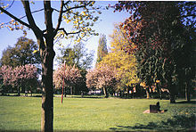
[25] The first was founded by a Quaker Pastor in the 1860s in the north of the then town, near the location of today's Spice Ball Park, and another a few years later under what is now the Beaumont Industrial Estate.
Banbury Rural District built Grimsbury Reservoir and the Langford Lane water pumping stations near today's Hennef Way road in abbot the mid-1960s.
There was a particularly nasty crash just north of Banbury in the winter of 1997, in which 1 person died and 9 were injured, due to a lorry hitting black ice and skidding into an oncoming tanker truck.
Hennef Way (A422) was then upgraded to a dual carriageway easing traffic on the heavily congested road and providing better links to north Banbury and the town centre from the M40.
From the former, the villages of King's Sutton and Middleton Cheney, and possibly also Aynho, Fenny Compton, Charlton and Croughton could be considered part of Banburyshire, and from the latter Upper and Lower Brailes also fall within Banbury's sphere of influence.