History of Rajasthan
During the Vedic Period present Rajasthan region known as Brahmavarta (The land created by the gods and lying between the divine rivers Saraswati and Drishadwati).
[4] In his long military career, Maharana Sanga achieved a series of unbroken successes against several neighbouring Muslim kingdoms, most notably the Lodi dynasty of Delhi.
While Jat kingdoms rise in early modern period include the Johiya of Jangaldesh, the Sinsinwars of Bharatpur State, as well as the Bamraulia clan and the Ranas of Dholpur.
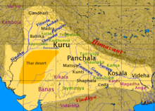
Painted Grey Ware culture (PGW) chiefdoms in the region were succeeded by Northern Black Polished Ware (NBPW) from c. 700–500 BCE, associated with the rise of the great mahajanapada states (mahajanapada states Kuru, Panchala, Matsya, Surasena and Vatsa)[14] It was located in central India near Kuru.
He gained prominence after the downfall of the Chavda kingdom in the course of resisting the invading forces led by the Arabs who controlled Sindh.
Nagabhata Pratihara I (730–756) later extended his control east and south from Mandor, conquering Malwa as far as Gwalior and the port of Bharuch in Gujarat.
In Battle of Rajasthan (738 CE), Nagabhata led a confederacy of Pratiharas to defeat the Muslim Arabs who had until then been pressing on victorious through West Asia and Iran.
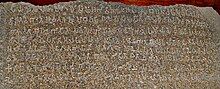
The Arab chronicler Sulaiman describes the army of the Pratiharas as it stood in 851 CE, "The ruler of Gurjara maintains numerous forces and no other Indian prince has so fine a cavalry.
"[26] Mihira Bhoja was the Greatest ruler of dynasty, kingdoms which were conquered and acknowledged his Suzerainty includes Travani, Valla, Mada, Arya, Gujaratra, Lata Parvarta and Chandelas of Bundelkhand.
During this period, the dynasty started claiming a prestigious origin, stating that its founder Guhadatta was a mahideva (Brahmin) who had migrated from Anandapura (present-day Vadnagar in Gujarat).
[35] The later bardic chronicles mention a fabricated genealogy, claiming that the dynasty's founder Guhaditya was a son of Shiladitya, the Maitraka ruler of Vallabhi.
R. V. Somani theorizes that the copper and zinc mines at Jawar were excavated during his reign, which greatly increased the economic prosperity of the kingdom.
The Bhonsle clan, to which the Maratha empire's founder Shivaji belonged, also claimed descent from a branch of the royal Sisodia family.
[47] The Bhati rulers originally ruled parts of Afghanistan; their ancestor Rawal Gaj is believed to have founded the city of Gajni.
Chahamanas classified the dynasty among the four Agnivanshi Rajput clans, whose ancestors are said to have come out of Agnikund sacrificial fire pit.
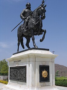
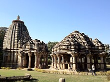
The indomitable Rana Kumbha defeated the Sultans of Malwa, Nagaur and Gujarat and made Mewar the most powerful Hindu kingdom in Northern India.
[91] Rana Sanga was removed from the battlefield in unconscious state from his vassals Prithviraj Singh I of Jaipur and Maldeo Rathore of Marwar.
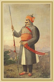
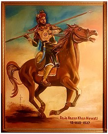
[96][97] Raja Hasan Khan Mewati hailed from the same lineage that had governed the Mewat region for nearly two centuries, asserting his sovereignty as a king.
[98][99] In military campaigns, Raja Hasan Khan Mewati featured prominently in the First Battle of Panipat, supporting Ibrahim Lodi against Babur.
Despite facing defeat, Hasan Khan Mewati remained resolute, aligning himself with Rana Sanga after Panipat to resist Babur's incursion into the region.
Tragically, during the battle, Hasan Khan Mewati succumbed to a fatal chest injury caused by a cannonball, marking the end of his life but leaving behind a legacy of bravery and resilience on the battlefield.
He also granted high offices to a large number of Rajput princes, and maintained cordial relations with them, such as Man Singh, one of the navaratnas.
[108] The arrival of the British East India Company in the region led to the administrative designation of some geographically, culturally, economically and historically diverse areas, which had never shared a common political identity, under the name of the Rajputana Agency.
The Company officially recognized various entities, although sources disagree concerning the details, and also included Ajmer-Merwara, which was the only area under direct British control.
Of these areas, Marwar and Jaipur were the most significant in the early 19th century, although it was Mewar that gained particular attention from James Tod, a Company employee who was enamoured of Rajputana and wrote extensively, if often uncritically, of the people, history and geography of the Agency as a whole.
Alliances were formed between the Company and these various princely and chiefly entities in the early 19th century, accepting British sovereignty in return for local autonomy and protection from the Marathas and Pindari depredations.
After India's independence, the word Rajasthan for this state was constitutionally recognized on January 26, 1950, on the recommendation of the P. Satyanarayana Rao Committee.
Also, in March 1948 Banswara, Bundi, Dungarpur, Jhalawar, Kishangarh, Kota, Pratapgarh, Shahpura and Tonk joined the Indian union and formed a part of Rajasthan.
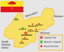
The princes finally agreed to sign the Instrument of Accession, and the kingdoms of Bikaner, Jodhpur, Jaisalmer and Jaipur acceded in March 1949.
The princes of the former kingdoms were constitutionally granted handsome remuneration in the form of privy purses and privileges to assist them in the discharge of their financial obligations.