Hurricane Ioke
Encountering warm waters, little wind shear, and well-defined outflow, Ioke intensified from a tropical depression to Category 4 status within 48 hours.
Two days later, favorable conditions again allowed for rapid strengthening, and Ioke attained Category 5 status on August 25 before crossing the International Date Line.
Later, the extratropical remnants of Ioke produced a severe storm surge along the Alaskan coastline, causing beach erosion.
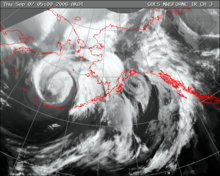
The Intertropical Convergence Zone (ITCZ) spawned a tropical disturbance with a low-level circulation far to the southeast of Hawaiʻi in the middle of August 2006.
Under the influence of a strong westward-moving subtropical ridge to its north, the disturbance tracked nearly due westward, with deep convection in the region increasing and decreasing on a daily basis.
It slowly became better organized, and early on August 20 the disturbance developed into Tropical Depression One-C while located about 775 mi (1,245 km) south of Honolulu, Hawaii.
[2] With wind shear practically non-existent and sea surface temperatures of around 82 °F (28 °C), conditions favored strengthening,[2] and operationally the cyclone was forecast to reach minimal hurricane status within four days before beginning to weaken.
[6] Near the International Date Line a frontal trough turned the hurricane to the northwest, and after a period of rapid deepening Ioke attained winds of 135 mph (215 km/h) early on August 22 while located about 280 mi (450 km) southeast of Johnston Atoll.
Strong upper-level cyclones far to its northwest provided outflow channels and light wind shear, with warm water temperatures along its path.
[12] Early on August 27, the pressure dropped to 915 mbar (27.0 inHg), and shortly thereafter Ioke crossed the International Date Line, becoming a 160 mph (260 km/h) typhoon.
[14] On August 29, the cyclone turned to the west and west-northwest while tracking around the periphery of the subtropical ridge, and Ioke again reached the equivalence of Category 5 status.
[13] The Japan Meteorological Agency (JMA) assessed Ioke as attaining peak 10‑minute sustained winds of 120 mph (195 km/h) on August 30.
[15] Later that day, the typhoon weakened to the equivalent of a Category 4 hurricane for the final time, and on August 31 Ioke passed very near Wake Island with winds of about 155 mph (250 km/h).
A deepening trough turned Ioke to the north-northwest and north,[19] and the cyclone weakened to a tropical storm a few hundred miles east of Japan.
Additionally, heavy rainfall from the typhoon left buildings flooded, with 2 ft (0.61 m) of standing water found several days after its passage.
[39] The United States Coast Guard first performed an aerial assessment of damage on Wake Island on September 2, three days after the typhoon struck.
[30] The United States Navy's combat stores ship, the USNS San Jose (T-AFS-7), and sixteen members United States Air Force's 36th Contingency Response Group at Andersen AFB, Guam arrived on September 8 and analyzed the stability of the airfield along with assisting in clean-up efforts, and after core tests workers cleared the runway to allow flights onto the territory.
[42] Ioke maintained at least Category 4 status for 198 consecutive hours, which was the longest continuous time period at that intensity ever observed for any tropical cyclone anywhere on Earth.

Tropical storm (39–73 mph, 63–118 km/h)
Category 1 (74–95 mph, 119–153 km/h)
Category 2 (96–110 mph, 154–177 km/h)
Category 3 (111–129 mph, 178–208 km/h)
Category 4 (130–156 mph, 209–251 km/h)
Category 5 (≥157 mph, ≥252 km/h)
Unknown