Interstate 710 and State Route 710 (California)
South of Atlantic Boulevard at the Bell–Vernon border, I-710 follows the course of the Los Angeles River, rarely wandering more than a few hundred feet from the riverbed.
The first spur splits at the 9th Street interchange, with the left-branching ramps crossing the Shoemaker Bridge over Los Angeles River[8] and becoming West Shoreline Drive as they head to downtown Long Beach, passing the Aquarium of the Pacific and the Long Beach Convention Center among other attractions.
The second spur continues south as Harbor Scenic Drive, leading to the eastern piers of the Port of Long Beach and the Queen Mary.
Meanwhile, the main segment continues south as the Seaside Freeway, keeping the I-710 designation, until the interchange with Ocean Boulevard, where offramps to Ocean Boulevard west carry both the Seaside Freeway name and I-710 designation across the Long Beach International Gateway Bridge.
[11] Legislative Route 167 (LR 167) was defined in 1933 to run from San Pedro east to Long Beach and north to Monterey Park.
[15] There are still remaining overhead street signs pointing motorists to SR 7 on Ford Boulevard at its intersection with Floral Drive in Monterey Park.
[18] In 2013, Caltrans adopted the remainder of the Seaside Freeway from Ocean Boulevard to SR 47 over the Gerald Desmond Bridge as part of Route 710.
[19][20] The significant growth of cargo volumes handled at the ports of Los Angeles and Long Beach has added a large amount of truck traffic to the Long Beach Freeway, since it is the most direct route between the port complex and the railyards in Vernon and East Los Angeles, as well as the Pomona and San Bernardino freeways that connect Los Angeles to railyards in San Bernardino and Colton.
The freeway's pavement has been badly damaged as a result since it was not designed to carry nearly as large of a load of truck traffic.
[22] In March 2018, Caltrans considered plans to expand I-710, which would have entailed adding lanes for trucks and demolishing homes.
However, a short unsigned freeway does exist in Pasadena, heading south from the interchange of I-210 and SR 134 to California Boulevard.
Currently, traffic headed for Pasadena on I-710 is redirected to I-10 (San Bernardino Freeway) eastbound by signs at the interchange between the two routes in Monterey Park.
Rather, traffic to the city is directed to take SR 19 (Rosemead Boulevard) northbound from its junction with I-10 (about 6 miles (9.7 km) east of the Long Beach Freeway) to reach Pasadena.
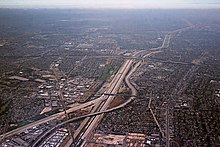
The areas around I-710, northeastern Los Angeles and the northwestern San Gabriel Valley are subject to traffic congestion.
Pro– and anti–I-710 lobbies have debated whether finishing I-710 would alleviate any of the San Gabriel Valley's traffic congestion, or merely displace it from surface streets to the freeway.
Caltrans and its local partner, the Los Angeles County Metropolitan Transportation Authority (Metro), researched the possibility of extending the Long Beach Freeway from Valley Boulevard to Pasadena by building a bored tunnel under Alhambra, El Sereno, and South Pasadena.
[4][36][37] Except where prefixed with a letter, postmiles were measured on the road as it was in 1964, based on the alignment that existed at the time, and do not necessarily reflect current mileage.