Margerie Glacier
The glacier begins on the southern slopes of Mount Root, elevation 12,860 feet (3,920 m), on the Alaska–Canada border flowing southeast down the valley, then turning to the northeast toward its terminus in Tarr Inlet.
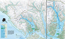
[2][3][4] Margerie Glacier extends upstream for a length of 21 miles (34 km) from Tarr Inlet to its source on the southern slopes of Mount Root.
The steep drop off of Margerie Glacier terminus allows cruise ships and smaller park tour boats to anchor nearby providing close-up views of ice calving.
[10] The ice wall has since retreated 65 miles (105 km) from the mouth of the bay and is only a remnant of the massive glacier seen by Vancouver.
This advance is not comparable to continental glaciation that occurred during the Wisconsin Ice Age of the Pleistocene epoch.
The advance was reduced to a rate of 30 feet (9.1 m) per year or about 1 inch (2.5 cm) per day until 1998 when some degree of recession was recorded as the northern part of the terminus formed a small embayment, while the southern part continued advancing at 1 foot (0.30 m) per year.
As this glacier calves, it disturbs the krill and small fish, thus making it an ideal spot for birds.

