1982 Marion tornado outbreak
[3] On the 12:00 UTC surface chart, a cold front was draped from Minnesota southwest across Iowa, Kansas, Oklahoma, and into Texas.
A triple point was found just south of Des Moines, Iowa, with a warm front positioned east across northern Illinois and Indiana.
Morning dew points ranged from 65 °F (18 °C) at Saint Louis, Missouri, and Louisville, Kentucky, to 72 °F (22 °C) at Memphis, Tennessee.
An outflow boundary was draped over Central Illinois and Missouri from overnight convection that was decaying as it tracked east across the two states.
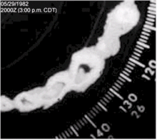
[17] At 3:16 p.m. the tornado either formed a new funnel or changed course as it tracked into the west side of Marion along Illinois Route 13, causing extensive damage throughout the city.