National Severe Storms Laboratory
The Warn-on-Forecast (WoF) research project aims to deliver a set of technologies for FACETs on a variety of space and time scales.
WoF aims to create computer-model projections that accurately predict storm-scale phenomena such as tornadoes, large hail, and extremely localized rainfall.
WoF Tornado Threat Prediction (WoF-TTP) is a research project to develop a 0–1 hour, 1-km resolution suite of high detail computer models to forecast individual convective storms and their tornadic potential.
The technology and science developed to achieve the WoF-TTP goal hopes to improve the prediction of other convective weather threats such as large hail and damaging winds.
The end result of this research will be a rich dataset with a diverse range of applications, including severe weather diagnosis and climatological information.
The HWT is designed to accelerate the transition of promising new meteorological insights and technologies into advances in forecasting and warning for hazardous mesoscale weather events throughout the United States.
TIM has the advantage of providing useful lead times for all locations downstream of the hazards, and continually removes the warning from areas where threat has already passed.
FLASH project development continues to be an active collaboration between members of NSSL's Stormscale Hydrometeorology and Hydromodeling Groups, and the HyDROS Lab at the University of Oklahoma.
In an effort to support NWS forecasters, NSSL investigates methods and techniques to diagnose severe weather events more quickly and accurately.
NSSL uses these AWIPS2 stations to test and demonstrate warning products and techniques that have been developed here that will be available in the NWS Forecast Office in the future.
NSSL: On-Demand is a web-based tool based on WDSS-II that helps confirm when and where severe weather occurred by mapping radar-detected circulations or hail on Google Earth satellite images.
National Weather Service (NWS) forecast offices, including those affected by the 2011 Super Outbreak, use the images to plan post event damage surveys.
Emergency responders use On-Demand to produce high-resolution street maps of affected areas, so they can more effectively begin rescue and recovery efforts and damage assessments.
The workstations in the lab can be quickly adapted for visualization and incorporation of unique data sources including dual-pol and phased array radars.
NSSL created a powerful research and development tool for the creation of new techniques, strategies and applications to better estimate and forecast precipitation amounts, locations and types.
Numerous two-dimensional multiple-sensor products offer assistance for hail, wind, tornado, quantitative precipitation estimation forecasts, convection, icing, and turbulence diagnosis.
The 3DVAR system uses data from the national WSR-88D radar network and NCEP's North American Mesoscale model product to automatically locate regions of thunderstorm activity.
[7] Probes are modified minivans with a suite of weather instruments mounted atop a roof rack and a complex of computer and communication equipment inside.
NSSL's 2DVD takes high speed video pictures, from two different angles, of anything falling from the sky through its viewing area (such as raindrops, hail or snow).
It is used in polarimetric radar studies by measuring rain rate, drop shape and size distribution, and other parameters useful in narrowing down the accuracy of precipitation identification algorithms.
NSSL has available small portable weather platforms with sensors that measure temperature, pressure, moisture, wind speed and direction, and an instrument called a Parsivel (PARticle, SIze, VELocity) disdrometer.
Measurements from the sensor packages attached to the balloons provide data about conditions inside the storm where it has often proved too dangerous for research aircraft to fly.
As they are carried up through electrified storms, these EFMs are designed to measure the strength and direction of the electric fields that build up before lightning strikes occur.
NSSL operates two mobile laboratories (custom built by an ambulance company) called NSSL6 and NSSL7, outfitted with computer and communication systems, balloon launching equipment, and weather instruments.
NSSL scientists hope to learn more about how storms produce intra-cloud and cloud-to-ground flashes and how each type is related to tornadoes and other severe weather.
NSSL uses special instruments mounted on the top of the National Weather Center that can measure the thermodynamic properties of the lowest 1–2 km of the atmosphere (boundary layer).
The mostly student-run NSSL/CIWRO Severe Hazards Analysis and Verification Experiment (SHAVE) collects hail, wind damage and flash flooding reports through phone surveys.
Its level of sophistication is appropriate for cutting edge research, yet it operates efficiently enough to produce high resolution guidance for front-line forecasters in a timely manner.
The HWT is designed to accelerate the transition of promising new meteorological insights and technologies into advances in forecasting and warning for hazardous mesoscale weather events throughout the United States.
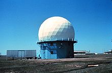
The NWRT was established to demonstrate the potential to simultaneously perform aircraft tracking, wind profiling, and weather surveillance as a multi-function phased-array radar (MPAR).