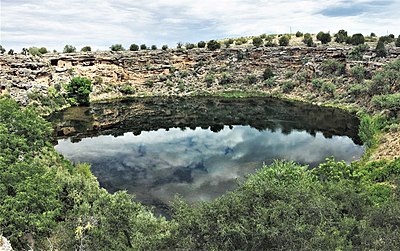
Montezuma Well
Montezuma Well is geologically very similar to the sinkholes and cenotes found in Florida and the Yucatán peninsula of Mexico, that is, a limestone cave which has collapsed to expose its subterranean water source.
[2] The earliest of the ruins located on the property (with the exception of the irrigation canal), a "pithouse" in the traditional Hohokam style, dates to about 1050 CE.
More than 50 countable "rooms" are found inside the park boundaries; it is likely that some were used for purposes other than living space, including food storage and religious ceremonies.
The Sinagua people, and possibly earlier cultures, intensively farmed the land surrounding the Well using its constant outflow as a reliable source of irrigation.
[2] The route of the modern canal is partly original, especially close to the outlet, but large portions have been re-routed over time as irrigation needs have changed.
In 1968, Montezuma Well was the subject of the first ever underwater archaeological survey to take place in a federally managed park, led by archaeologist George R Fischer.