Mount Elden
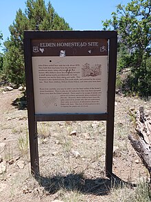
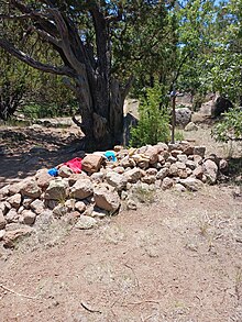
It takes its name from one of the region's earliest Anglo settlers, John Elden, who, along with his family, established a homestead on the mountain's lower slopes and grazed sheep on the open grasslands below during the late 19th century.
Much of the vegetation on the southern and southeastern slopes of the mountain was destroyed by the human-caused Radio Fire in 1977 which burned 4,600 acres (1,900 ha).
[4] Despite its rugged appearance, steep relief, and nearly 15 square miles (40 km2) of surface area,[5] Mount Elden is easily accessible via an extensive, well-developed road and non-motorized trail system that is part of the Coconino National Forest.
Mount Elden is one of six hundred volcanoes that dot the San Francisco volcanic field in Northern Arizona.
Geologic evidence suggests that the eruption of the mountain, which occurred at linear vents along regional faults, was a non-explosive event that took place during several flow sequences.