Nishnabotna River
The source of the spill originated when a valve was left open on a storage tank over the weekend of March 9-11 at NEW Cooperative, an agricultural business in Red Oak, Iowa.
The leak drained approximately 265,000 gallons of liquid nitrogen fertilizer into the nearby East Nishnabotna River.
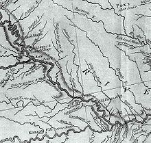
"[5] The East Nishnabotna rises in southwestern Carroll County and flows generally south-southwestwardly through Audubon, Cass, Pottawattamie, Montgomery, Page and Fremont Counties, past the towns of Exira, Brayton, Atlantic, Lewis, Elliott, Shenandoah, Red Oak and Riverton.
[6] The West Nishnabotna River rises in southwestern Carroll County and also flows generally south-southwestwardly through Crawford, Shelby, Pottawattamie, Mills and Fremont Counties, past the towns of Manning, Irwin, Kirkman, Harlan, Avoca, Hancock, Oakland and Carson.
The Nishnabotna forms roughly the southeastern border of the 5,000 acre McKissick Island which was the land Nebraska and Missouri both claimed.