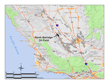
North Belridge Oil Field
The climate in the North Belridge area is arid to semi-arid, with an average annual rainfall of 5 to 6 inches (130 to 150 mm), almost all in the winter months.
The North Belridge Field, like the South Belridge and the others nearby (Cymric, Monument Junction, McKittrick, Antelope Hills, and others) is near the western margin of the huge San Joaquin Basin, a region of extensive sedimentary rocks of varying porosity and permeability, containing anticlinal folds and copious quantities of petroleum, much of which has been extracted in the early and middle 20th century.
The fourth pool – the Temblor Sand – is within the Monterey Formation, the wide-ranging unit throughout much of coastal California which is the probable source rock for much of the state's oil.
The Oligocene portions of the stratigraphy, including the Bloemer/Belridge 64/Gibson pools, are an old submarine fan, cut off from its source units by movement of the plates along the San Andreas Fault.
However the North Belridge component of the giant field had several small independent operators, most of which have either left or have been acquired by larger companies.
American Energy produces from the Dow Chanslor lease, which straddles the boundary between the North and South Belridge fields, while Greka maintains a group of production wells along Highway 33 in the northeast portion, in the Belridge, Gibson and McPhail leases.
[8] Several enhanced recovery methods have been employed at the North Belridge Field, including cyclic steam (the "huff and puff" method, on the heavy oil in the Tulare pool); steam flooding; gas injection (on the Temblor Sands and the Y Sand); and waterflooding.