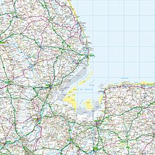
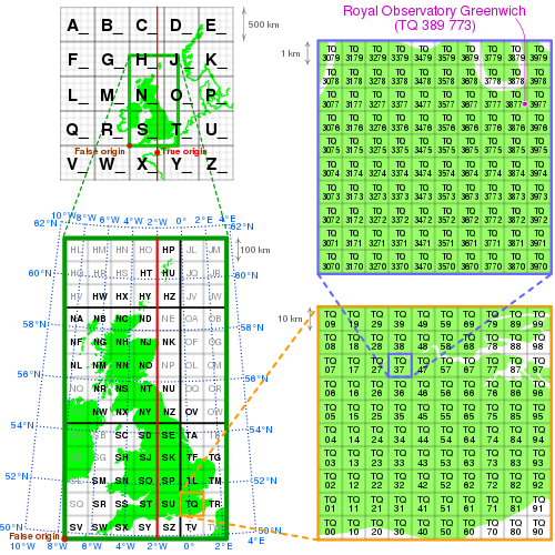
Ordnance Survey National Grid
Grid references are also commonly quoted in other publications and data sources, such as guide books and government planning documents.
A number of different systems exist that can provide grid references for locations within the British Isles: this article describes the system created solely for Great Britain and its outlying islands (including the Isle of Man).
European-wide agencies also use UTM when mapping locations, or may use the Military Grid Reference System (MGRS), or variants of it.
The most common usage is the six figure grid reference, employing three digits in each coordinate to determine a 100 m square.
Grid references may also be quoted as a pair of numbers: eastings then northings in metres, measured from the southwest corner of the SV square.
For example, within the context of a location known to be on OS Landranger sheet 41 (which extends from NN000500 in the south-west to NN400900 in the north-east) the abbreviated grid reference 166712 is equivalent to NN166712.
The numbering follows a grid index where the tens denote the progress from West to East and the units from South to North.
[citation needed] It replaced the Cassini Grid which had previously been the standard projection for Ordnance Survey maps.
A geodetic transformation between OSGB 36 and other terrestrial reference systems (like ITRF2000, ETRS89, or WGS 84) can become quite tedious if attempted manually.
[10][11] This models the detailed distortions in the 1936–1962 retriangulation, and achieves backwards compatibility in grid coordinates to sub-metre accuracy.
The longitude and latitude positions on OSGB 36 are the same as for WGS 84 at a point in the Atlantic Ocean well to the west of Great Britain.