Ohio State Route 43
Created in the mid-1920s, State Route 43 starts out in Steubenville, and runs northwesterly to Canton via Carrollton.
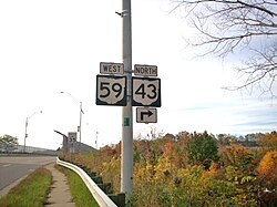
From Canton, the highway runs northerly through Kent and Streetsboro to Aurora, where it then turns northwesterly through Solon, Ohio, and continues passing through suburban Cleveland before entering the city proper, and coming to an end in downtown at Public Square.
State Route 43 runs through the counties of Jefferson, Carroll, Stark, Portage, Geauga and Cuyahoga.
[2] Beginning in Jefferson County at its southern terminus at a signalized intersection with State Route 7 in Steubenville along the Ohio River and the Ohio-West Virginia border across from Weirton, West Virginia, State Route 43 follows Washington Street northwesterly before becoming a short divided highway just west of downtown.
The state highway then departs the town to the northwest along Canton Road, leading up to a diamond interchange with the U.S. Route 22 freeway.
The two state routes run westerly through Malvern along Canal Street, then onto Alliance Road after departing the village, and ultimately to the point where they cross into Stark County.
Turning northwesterly into rural Sandy Township, State Route 43 makes its way up into Canton.
Further north, after crossing the Mogadore Reservoir, State Route 43 meets Interstate 76 at Exit 33 just south of Kent in Brimfield.
When the two directions of traffic converge into North Mantua Street, State Route 43 becomes a four- to five-lane roadway.
After crossing underneath the Ohio Turnpike, State Route 43 continues north into Aurora and is known as Chillicothe Road.
[5][6] In 1930, State Route 43 was rerouted along a previously unnumbered road which put it approximately one mile west of North Olmsted.