Orthophoto
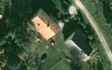
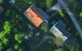
An orthophoto, orthophotograph, orthoimage or orthoimagery is an aerial photograph or satellite imagery geometrically corrected ("orthorectified") such that the scale is uniform: the photo or image follows a given map projection.
Unlike an uncorrected aerial photograph, an orthophoto can be used to measure true distances, because it is an accurate representation of the Earth's surface, having been adjusted for topographic relief,[1] lens distortion, and camera tilt.
Orthophotographs are commonly used in geographic information systems (GIS) as a "map accurate" background image.
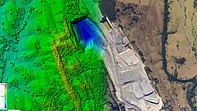
A digital elevation model (DEM) is required to create an accurate orthophoto as distortions in the image due to the varying distance between the camera/sensor and different points on the ground need to be corrected.
Software can display the orthophoto and allow an operator to digitize or place linework, text annotations or geographic symbols (such as hospitals, schools, and fire stations).