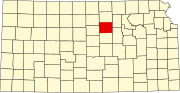
Ottawa County, Kansas
For many millennia, the Great Plains of North America was inhabited by nomadic Native Americans.
In 1802, Spain returned most of the land to France, but keeping title to about 7,500 square miles.
In 1803, most of the land for modern day Kansas was acquired by the United States from France as part of the 828,000 square mile Louisiana Purchase for 2.83 cents per acre.
Following amendment to the Kansas Constitution in 1986, Ottawa County remained a prohibition, or dry county until 2006, when voters approved the sale of alcoholic liquor by the individual drink with a 30% food sales requirement.
Ottawa County is part of the Salina, KS Micropolitan Statistical Area.
No Democratic presidential candidate has won Ottawa County since Lyndon Johnson in 1964, and the last to reach thirty percent of the county's vote was Michael Dukakis in 1988 during a major Great Plains drought.
[14] † means a community is designated a Census-Designated Place (CDP) by the United States Census Bureau.
The city of Minneapolis is considered governmentally independent and is excluded from the census figures for the townships.

