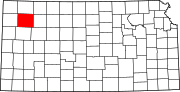
Thomas County, Kansas
[2] The county was named after George Thomas, a Union general during the Civil War.
For many millennia, the Great Plains of North America was inhabited by nomadic Native Americans.
In 1802, Spain returned most of the land to France, but keeping title to about 7,500 square miles.
In 1803, most of the land for modern day Kansas was acquired by the United States from France as part of the 828,000 square mile Louisiana Purchase for 2.83 cents per acre.
It was named for George Thomas, a Union general during the Civil War and hero of the Battle of Chickamauga.
The last time a Democratic candidate has carried Thomas County was in 1964 by Lyndon B. Johnson.
† means a community is designated a Census-Designated Place (CDP) by the United States Census Bureau.
[15] The city of Colby is considered governmentally independent and is excluded from the census figures for the townships.

