Pennsylvania Route 73
Predating the Interstate and U.S. Highway Systems, the Skippack Pike, a modern section of the route, served as the primary connector between Philadelphia and the northwest suburbs.
PA 73 was shifted to its current routing to the Tacony–Palmyra Bridge in the 1960s, having previously followed Frankford Avenue and Robbins and Levick streets on a one-way pair.
From this intersection, the route heads northeast on two-lane undivided Lake Shore Drive past a mix of farm fields and development, passing south of Schuylkill Valley High School.
Past the lake, PA 73 enters Maidencreek Township and comes to a bridge over Norfolk Southern's Evansville Industrial Track railroad line as it runs through agricultural areas with some homes.
PA 73 continues along Main Street and runs through residential areas in the community of Blandon, where it crosses Norfolk Southern's Reading Line at-grade.
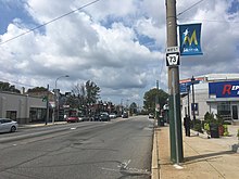
The route turns southeast through wooded areas with some residential and commercial development and intersects PA 12 in Breezy Corner.
The route heads into a mix of farmland and woodland with some homes, crossing the Manatawny Creek before curving southeast and passing through the community of Pleasantville.
The road leaves the Oley Valley region and enters Earl Township, running through forested areas with some fields and residences and passing through Shanesville.
Past this interchange, the route becomes a three-lane road with a center left-turn lane and passes a mix of homes and businesses in the community of Gilbertsville.
The route continues into Lower Frederick Township and passes through farmland with some development before it reaches a roundabout at PA 29 in the community of Zieglerville.
Past this intersection, PA 73 runs through a mix of fields, woods, and homes and comes to a bridge under I-476 (Pennsylvania Turnpike Northeast Extension) immediately before it crosses North Wales Road into Whitpain Township in the community of Belfry.
The road heads across CSX's Stony Creek Branch railroad line at-grade and passes residential neighborhoods prior to reaching a junction with US 202 in commercial areas in the community of Center Square.
PA 73 heads into Whitemarsh Township at the Butler Pike intersection in the community of Broad Axe and runs through a mix of fields and woods with some homes, passing under the Pennsylvania Turnpike (I-276).
The road crosses the Wissahickon Creek in Fort Washington State Park before it comes to Bethlehem Pike in the community of Whitemarsh.
[4][6] PA 73 follows Bethlehem Pike south under Norfolk Southern's Morrisville Line and widens to a four-lane road.
The route splits from Bethlehem Pike by heading southeast onto two-lane undivided Church Road, passing suburban neighborhoods and entering Springfield Township.
PA 73 continues past homes as a two-lane undivided road and enters Cheltenham Township, where it runs to the northeast of Westminster Theological Seminary and a cemetery.
The route continues southeast through wooded residential neighborhoods in Wyncote, passing between the Reconstructionist Rabbinical College to the north and Curtis Arboretum to the south before it comes to an intersection with Washington Lane.
At this point, PA 73 turns northeast onto four-lane undivided Washington Lane and passes near more homes before coming to a bridge over Chelten Hills Drive, the Tacony Creek, and SEPTA's Main Line.
The route gains a center left-turn lane and runs past residential and commercial development, passing to the northeast of Jefferson Moss-Magee Rehabilitation Hospital – Elkins Park.
[4][6] At the Laurel Avenue intersection, PA 73 becomes Cottman Avenue and turns into a three-lane road with one eastbound lane and two westbound lane that forms the border between the city of Philadelphia in Philadelphia County to the northeast and Cheltenham Township in Montgomery County to the southwest, coming to the entrance to the Fox Chase Cancer Center and Temple University Hospital – Jeanes Campus to the northeast of the road.
PA 73 heads into Northeast Philadelphia and becomes a four-lane road as it runs through commercial areas, reaching a bridge over CSX's Trenton Subdivision railroad line.
The route continues past several shopping centers and intersects Bustleton Avenue, at which point it passes southwest of Roosevelt Mall.
PA 73 passes near urban homes and commercial development and comes to a ramp to northbound I-95 at the Princeton Avenue intersection.
From Reading, PA 73 split from US 422 in Mount Penn and followed Carsonia Avenue and Friedensburg Road to Oley, where it picked up its current routing to Cheltenham Township.
[25] On November 24, 1998, an act of the Pennsylvania General Assembly designated the portion of PA 73 between North Wales Road and Butler Pike in Whitpain Township as the POW/MIA Memorial Highway in honor of soldiers who are prisoner of war (POW) or missing in action (MIA).
[27][28] In 2009, a $212.3 million project began to reconstruct the interchange between PA 73 and I-95 as part of rebuilding the stretch of I-95 through Northeast Philadelphia.
[33] On January 31, 2025, a Learjet 55 medical aircraft crashed on PA 73 in Northeast Philadelphia near the intersection with Roosevelt Boulevard (US 1).
As a result, a portion of the route between Roosevelt Boulevard and Bustleton Avenue was closed for five days for cleanup and crash site investigation, eventually reopening on February 5, 2025.