Posidonia Shale
[8] The formation comprises finely laminated layers of oil shales formed of fine-grained sediments intercalated with bituminous limestones and crops out in a number of locations in southwestern Germany, although most remains are from near the village of Holzmaden and Dotternhausen.
It is recovered laterally extensive within Germany belonging to the early Toarcian Central European Epicontinental Basin, that evolved gradually from low tophography tidal flat to floodpains to a shallow shelf sea with intermittent N connection with the Viking Corridor and the Proto-Atlantic Ocean and with the Tethys Ocean towards the S, that filled with seawater the area, subdivided in several subasins with heterogeneous conditions and biotas, from the Netherlands to the Tirol Area.
[11][12] In the Mesozoic was marked by the breakup of Pangea during the Late Triassic, what led to the appearance of the early Atlantic connecting with the Boreal waters of the Panthalassa Ocean, and several marine to continental subasins locally.
[14] The granites and gneisses resulting from crystallization were eroded from the Paleozoic exposures on the east, and were deposited on the Jurassic prograded alluvial nearshore sandstone that evolved gradually into the Bajocian layers.
[15] The next are the called "Koblenzer-Hainzen" clay successions of upper the semicelatum subzone, initially poorly layered and more or less bituminous with abundance of Steirmannia radiata and Dactylioceras semieelatum.
[16] The Unteren Schiefern layers (Exaratum) appear next marked by the highest bitumen content and characterized by very fine light/dark stratification, abundance of pyrite, fine-grained weathering and the largely absence of bioturbation derived from anoxic conditions while the accumulation of exceptional preserved fossils indicate very weak water movement.
[16] The Mittleren Schiefer/Schieferklotz (upper exaratum to lower elegans subzones) become increasingly poorly layered until it becomes a small brittle limestone bank, the "Stinkkalkbank" (Dotternhausen to Gomaringen and Nürtingen) with Coelodiscus shells, low on bitumen and with biota that marks better oxygenated conditions, such as foraminifera and occasional ostracods.
[15] The Obere and Wilder Stein (upper elegans) medium to brown-gray always remain formed as a regular limestone bank of approximately uniform thicknessis, rarely laminated (Dotternhausen) and often shows traces of minor bioturbation (Dotternhausen, Mössingen, Gomaringen; Aalen-Wasseralfingen), becoming calcified towards the upper limit between Nürtingen and Holzmaden, marked with increased presence of Cucullaea muensteri as well foraminifera and ostracods, as well scoria horizons with fish, cephalopod and larger vertebrate remains, as well often contain belemnite rostrums.
[15] The last level of the formation is the Wilden Schiefer (probably reaching Bifrons zone) with the presence of "Monotis bank", from Altdorf to Dotternhausen and Göppingen area, with slates getting poorer in bitumen and less layered.
[2] The Sachrang Shales where cited originally on the restudy of the Alpine Upper Black Slate, composed with dark gray, somewhat sandy, disintegrating into thin but large plates of Marl that overlies Pliensbachian breccia.
The presence of altered Celadonite, suggest volcanogenic solutions as the most probable source, where the high amounts of dissolved manganese of continental origin was translated to the epicontinental margins of the Tethys.
[17] According to sedimentologic and palynologic features, a tidally influenced transgressive development within the Lower Toarcian is inferred with increased continental matter being moved to marine areas causing anoxic conditions, with the Posidonia Shale being the reference formation for this interval.
[12] On the other hand, Black shale formation in the Toarcian of NW Germany is associated with a major turnover in phytoplankton assemblages interpreted as the response to lowered salinities in surface waters of the epicontinental sea.
Dormettingen shales have been calculated biochronologically and with isochron data, giving an approximate age of 183-181 million years, being close to the Pliensbachian boundary based on the recent revisions of the Early Jurassic Subperiods.
[26] Many people did important geological and paleontological research on the Swabian Posidonia Shale, including Carl Hartwig von Zieten (1785–1846), Eberhard Fraas (1862–1915), Bernhard Hauff senior (1866–1950) and Adolf Seilacher (1925–2014).
Several fossils were reported, studied and named at the time from locations such as Banz Abbey, Ohmden, Holzmaden or Dotternhausen, including Macrospondylus in 1824 (As Steneosaurus, being originally identified as a Gharial), the pterosaur Dorygnathus (as a species of Pterodactylus) in 1830, the fish Lepidotes, the selachian Hybodus or the crinoid Pentacrinites.
[30] While in 1921, the 1st major fossil inventory was done by Hauff, reporting exquisite specimens, most of them from Holzmaden and some of them nearly complete, including Ammonites, Fish and Marine reptiles, such as Plesiosaurs and Icthyosaurs.
[36][37] With the addition of multiple new references, the expansion of information thanks to the revision of profiles, boreholes and other outcrops, new works on the characteristics of the deposition, the type of environment and the conditions that led to the exquisite preservation were produced, where paleocurrents where found to be nfluenced from the North and the South of the Central European Basin.
[42] The Posidonia Shale was located in the SW and NW Germanic basins, as part of a shallow epicontinental sea, surrounded and influenced by various highs and emerged lands that provided most of the terrestrial matter found along the Formation.
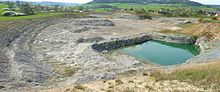
The main outcrops of the formation are disposed along the modern southern Germany, recovering the locations of Holzmaden, Ohmden, as well at Niedersachsen, and others appearing along the east, such as the related to the Banz Abbey strata or Regensburg.
[45] The Vindelician Land/High has been represented as a peninsula to the Bohemian Massif, or an isolated landmass, that is due to its connections that had not been recovered in depth, being considered a mostly plain emerged sedimentary structure.
[12] The Toarcian epicontinental seas of Europe where driven by several global events and changes present on the surface, like the coeval Karoo-Ferrar eruptions in the Southern Hemisphere, what created an enhanced hydrological cycle & oxygen depletion, allowing exceptional preservation.
This stage was marked with the presence of a general deposition of shale mudrock along with strong variations on the associated organic matter, associated with extincions such as the Toarcian Oceanic Anoxic Event.
[50] The black shales characteristic of this unit reveal a shallow marine environment, influenced by arctic and Tethyan waters, with marked episodes of disappearance of benthic biota.
[57] In the east the SW German sub-basin was bounded by the Bohemian-Hercynian landmass (Modern Bohemian Massif), with the Vindelician peninsula at the S-SW, reaching the west area of Augsburg.
[58] The Bohemian Massif was located in a relatively warm, precipitation-rich climate with Bavarian shallow areas receiving freshwater inflows from the east, which temporarily lowered the salinity of the seawater in the whole basin or in parts.
This Mudstone contains charred organic material typically connected to Wildfires along with large amounts of expandable Smectite possibly derived from alteration of volcanic ash, what indicated a clear contribution of volcanic-derived detritus during deposition.
[59] In the Austrian area, the volcanic materials where probably also sourced by the rift history of the Valais, Briançonnais [fr] and Piemonte-Liguria domains (Sinemurian-Callovian), and the Toarcian break-up of the Ligurian-Penninic oceanic realm.
[59] Occurs only in the south-east of the northern Bavarian Jura region, as appears on places like Bruck in der Oberpfalz, the north-east of the Banz Abbey, Wittelshofen, Regensburg and Bodenwöhr, composed mostly by coarse grained sediments, clusters of clay sandstone and sand-lime stone facies (shale, slightly bituminous in layers, and sandstone, older lias sand, sand marl, marl, oolithic limestone and sand-lime banks).
[69] The museum has several halls with different kinds of fauna found on the layers of the formation, where the vertebrate specimens are exposed on the main parts, including on those Icthyosaur remains and several fishes.