Red River of the North
Originating at the confluence of the Bois de Sioux and Otter Tail rivers between the U.S. states of Minnesota and North Dakota, it flows northward through the Red River Valley, forming most of the border of Minnesota and North Dakota and continuing into Manitoba.
It empties into Lake Winnipeg, whose waters join the Nelson River and ultimately flow into Hudson Bay.
[3] The river falls 70 metres (230 ft) on its trip to Lake Winnipeg, where it spreads into the vast deltaic wetland known as Netley Marsh.
The river was long used by fur traders, including the French and the Métis people, who established a community in this area some time before the British defeated France in the Seven Years' War.
[7] It is remarkably flat; from its origin near Breckenridge, Minnesota, to the international border near Emerson, Manitoba, its gradient is only about 1:5000 (1 metre per 5 kilometres), or approximately 1 foot per mile.
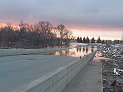
Heavy snows or rains, especially on saturated or frozen soil, have caused a number of catastrophic floods, which often are made worse by the fact that snowmelt starts in the warmer south, and waters flowing northward are often dammed or slowed by ice.
[8] Floods happen in the Red River when the water level increases over the tops of riverbanks due to significant precipitation over the same area for long periods, in the forms of persistent thunderstorms, rain, or snow combined with spring snow melt and ice jam.
Atashi et al. study conducted spatial analyses of the Permanent Water Area (PWA) and Seasonal Water Area (SWA), revealing a specific vulnerable section near Grafton city, located between Grand Forks and Emerson, that is highly susceptible to severe floods.
[15] Eight dikes protecting Winnipeg gave way and flooded much of the city, turning 1,600 km2 (600 sq mi) of farmland into an enormous lake.
The Red River Floodway around Winnipeg attracted some derision at the time, as some people thought it was massively overbuilt and was the then-largest earth-moving project in the world.
[citation needed] In the spring of 1997 a major flood of the Red River caused a total of $3.5 billion in damage and required temporary evacuation of towns and cities on both sides of the border.
The cities worked with FEMA and the state of Minnesota to clear the floodplains of the river on both sides, prohibiting future housing or businesses in this area.
They created the Greater Grand Forks Greenway on both sides, which includes city and state parks, a long bike trail, and other recreational amenities.
In East Grand Forks, a removable flood wall was constructed in the downtown area so that residents did not lose their connection to the river.
[19] The river crested at the James Avenue pumping station in Winnipeg at 22.5 feet (6.9 m) above datum, making it the fourth-highest flood in recorded history.