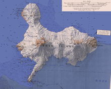
Windless Bight
It was named by the Winter Journey Party, led by Wilson, of the British Antarctic Expedition, 1910–13, which encountered no wind in this area.
[5] The Preparatory Commission for the Comprehensive Nuclear-Test-Ban Treaty Organization (CTBTO) has its IS55 infrasonic array on Windless Bight about 26 kilometres (16 mi) northeast of McMurdo Station.
This was confirmed by an infrasonic microphone array that was established in 1976 by the Geophysical Institute of the University of Alaska Fairbanks, sponsored by the National Science Foundation (NSF).
[2] The University of Alaska Fairbanks, under contract to the CTBTO, prepared the site for the IS55 infrasonic array and installed the equipment, which was completed in February 2001.
Infrasonic data from each element of the array, along with the weather information, is formatted at the CRF into 30-second packages, which are sent by satellite link from McMurdo Station to Brewster, Washington, Denver, Colorado and Vienna, Austria.
A rock spur along the east flank of Hut Point Peninsula, 7.5 nautical miles (13.9 km; 8.6 mi) southwest of the Vee Cliffs, on the south side of Ross Island.
A headland 3.2 nautical miles (5.9 km; 3.7 mi) northeast of Sultans Head Rock on the south side of Ross Island.
An icebreaker, "she" made nine Antarctic deployments in support of science activities from U.S. Navy (USN) Operation Deep Freeze, 1955–56, through the 1966–67 season.
A small bay immediately west-northwest of Terror Point in Windless Bight, on the south side of Ross Island.
So named by the Winter Journey Party, led by Wilson of the British Antarctic Expedition (BrAE), 1910-13, in July 1911 because of the thick white fog they encountered in this locality.
It marks the east limit of Fog Bay, 4 nautical miles (7.4 km; 4.6 mi) west-northwest of Cape MacKay.
Discovered by the BrNAE (1901–04) and named for Captain Harry MacKay, commander of the Terra Nova, one of the relief ships for the expedition.