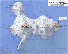
Kyle Hills
The hills extend east–west for 8 nautical miles (15 km), rising from sea level at Cape Crozier to about 2,600 metres (8,500 ft) in Mount McIntosh at the western end of the group.
[1] Named by United States Advisory Committee on Antarctic Names (US-ACAN) (2000) after Philip R. Kyle, Professor of Geochemistry, New Mexico Institute of Mining and Technology, Socorro, New Mexico, who worked extensively in Antarctica over 28 field seasons, 1969–2000; completed six seasons under New Zealand Antarctic Research Program (NZARP) auspices, 1969–76 He was the principal investigator on numerous National Science Foundation research projects in 23 seasons of field work under United States Antarctic Program auspices, 1977–2000, with focus on long-term research of the volcano Mount Erebus, and was in charge of the Mount Erebus Volcano Observatory, 2000.
[1] Download coordinates as: Named features in the western part of the hills near Mount Terror include, from west to east,
It stands at the northwest end of Lofty Promenade, 1.5 nautical miles (2.8 km; 1.7 mi) east of the summit of Mount Terror.
Kyle, named by Advisory Committee on Antarctic Names (US-ACAN) (2000) after William C. McIntosh, geologist, New Mexico Institute of Mines and Technology, who worked extensively in Antarctica under United States Antarctic Project (USAP) auspices and in support of Kyle's investigations on Mount Erebus; made first trip to Mount Erebus in 1977-78 and at least 15 trips through 1999.
Kyle, named by Advisory Committee on Antarctic Names (US-ACAN) (2000) after Raymond R. Dibble, geophysicist, Victoria University of Wellington, New Zealand, who visited Cape Crozier in the 1962-63 season; made seismic and volcanic observations of Mount Erebus during the 1970s, also 1980-86 as a founding member of the International Mount Erebus Seismic Studies (IMESS); after retirement from Victoria University and involvement with NZAP, Dibble joined United States Antarctic Project (USAP) and the NMIMT team (Kyle) in the maintenance and upgrading of the seismic stations run by the Mount Erebus Volcano Observatory, 1993–94, 1994–95, 1995–96, and 1997-98.
A prominent peak, 1,240 metres (4,070 ft) high, located 3 nautical miles (5.6 km; 3.5 mi) southwest of Post Office Hill.
Named after David G. Ainley, Point Reyes Bird Observatory, Stinson Beach, CA, a United States Antarctic Project (USAP) ornithologist who studied penguin and skua populations at Cape Crozier and McMurdo Sound in six seasons, 1969-70 to 1983-84.
Gamble, geologist, Victoria University of Wellington, New Zealand, who participated in three United States Antarctic Project (USAP) field projects under Kyle's leadership, 1981–82, 1982–83, and 1984–85; later with NZAP on the West Antarctic Volcano Exploration, 1989–90, a collaborative US-UK-NZ effort in Marie Byrd Land; extensive work on Xenoliths that occur in volcanic rocks, including work at Cape Crozier and Cape Bird on Ross Island.
A prominent hill, 430 metres (1,410 ft) high, standing 4 nautical miles (7.4 km; 4.6 mi) northwest of The Knoll and overlooking the Adelie penguin rookery of Cape Crozier.
A point 1 nautical mile (1.9 km; 1.2 mi) north of Post Office Hill that marks the northeast extremity of Ross Island.
An exposed volcanic cone near Cape Crozier, located 1.75 nautical miles (3.24 km; 2.01 mi) northwest of the summit of The Knoll.
Named by Advisory Committee on Antarctic Names (US-ACAN) (2000) after Larry F. Lutz, electrical engineer, Institute for Physical Science and Technology, University of Maryland, a specialist in the development of scientific research instrumentation for ground based, balloon, and rocket sounding programs for United States Antarctic Project (USAP); 17 summer seasons at McMurdo, South Pole, and Siple Stations, 1980-2000.
Kyle, named by Advisory Committee on Antarctic Names (US-ACAN) (2000) after Kurt S. Panter, who, as a Ph.D. student at New Mexico Institute of Mining and Technology, worked extensively in Marie Byrd Land where he completed his dissertation on rocks from Mount Sidley; also assisted with work on Mount Erebus in five field seasons, 1988-96.
A rock bluff rising to 1,000 metres (3,300 ft) high 1.5 nautical miles (2.8 km; 1.7 mi) south-southeast of Ainley Peak.
The steep rock bluff face marks the east end of a mound-shaped and mostly ice-covered elevation 0.5 nautical miles (0.93 km; 0.58 mi) northwest of Detrick Peak.
Named by Advisory Committee on Antarctic Names (US-ACAN) (2005) after Terrie/Theresa M. Williams Professor of Ecology and Evolutionary Biology, University of California, Santa Cruz; United States Antarctic Project (USAP) co-principal investigator of hunting behavior of free-ranging Weddell seals, several seasons in McMurdo Sound sea ice areas, 1984-2002[20]
A sharp peak, about 700 metres (2,300 ft) high standing 1 nautical mile (1.9 km; 1.2 mi) east-southeast of Lutz Hill.
Named by Advisory Committee on Antarctic Names (US-ACAN) (2000) after Daniel L. Detrick, physicist/engineer, Institute for Physical Science and Technology, University of Maryland, involved in long-term ionospheric research with United States Antarctic Project (USAP), including the design and fabrication, as well as deployment of instruments at McMurdo, South Pole, and Siple Stations; more than a dozen visits to Antarctica from 1980.
An exposed volcanic cone near Cape Crozier, located 1.2 nautical miles (2.2 km; 1.4 mi) west-northwest of the summit of The Knoll.