Thames school of chartmakers
[3][4] Its existence was revealed by Spanish historian of science Ernesto García Camarero,[3][4] who examined a number of 17th-century English charts and noticed some common features.
[7] They had (wrote García Camarero) a certain unfussy unity of style: "The design of the mapping closely followed the traditional Mediterranean form; but whereas an overripe Baroque has infected the latter, the English school, by its restraint, manages to reinvigorate the decadent portolan.
[9] University of Kansas scholar Thomas R. Smith discovered a number of these men were members of the Drapers' Company,[10] a guild of the City of London, and from its records he[11] and Tony Campbell[12] derived trees of master-and-apprentice relations spanning 125 years.
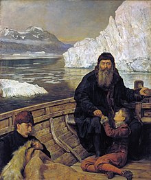
[13] The English came late to the art of oceanic navigation, the rudiments of which they learned from the Portuguese and (especially during the marriage of Mary Tudor and Philip II of Spain) the Spanish [14] Their charts were lacking and they needed to catch up.
David W. Waters said that as late as 1568 probably only one English seaman was capable of navigating to the West Indies without the aid of Portuguese, French or Spanish pilots.
Yet, by the time of the Armada, a mere score of years later, Englishmen had gained a "reputation of being above all Western nations, expert and active in all naval operations".
[24][25][26][27] However, few good Dutch charts of North America could be obtained, so the Thames chartmakers were obliged and stimulated to evolve original works: "The English made maps because they had to", wrote Jeanette D.
[32] "Beautiful to the modern eye", wrote Alaistair Maeer, and made with colourful scales and intricate compass roses, in other respects early Thames school charts were plain and unadorned, concentrating on the practical business of navigating.
[33] For Maeer, the contrast was striking, and his explanation was that the Portuguese, Spanish and Dutch charts of the era were produced at the behest of state-sponsored institutions[34] who routinely projected religious or political symbols asserting dominion and mastery.
The Thames school charts, however, were not a product of government oversight; and imperial aggrandisement was not yet a motivation for English voyagers, who saw the world in terms of opportunities for buying and selling.
[42] Probably, most existing Thornton specimens would have perished had not French privateers captured an East Indiaman with her complement of charts: they were preserved for posterity in the Service Hydrographique de la Marine.