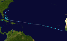
Timeline of the 2013 Atlantic hurricane season

These dates, adopted by convention, historically delimit the period in each year when most tropical systems form.

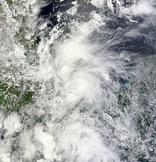
That same month, on the opposite side of the country, Hurricane Manuel made multiple landfalls along Mexico's Pacific coast, causing catastrophic damage.

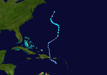
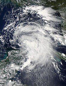
After coming ashore in Florida's Big Bend region, it killed at least three and brought tornadoes, heavy rainfall, and flooding to a large section of the U.S. East Coast and Atlantic Canada.

[6][7] This timeline documents tropical cyclone formations, strengthening, weakening, landfalls, extratropical transitions, and dissipations during the season.

Additionally, figures for maximum sustained winds and position estimates are rounded to the nearest 5 units (knots, miles, or kilometers), following the convention used in the National Hurricane Center's products.

A mid-grade tropical storm prior to moving ashore in Florida's Big Bend region.
Tropical Storm Andrea prior to landfall on June 6
A visible satellite image of a fast-moving and weak tropical storm in the central Atlantic.
Tropical Storm Chantal in the central Atlantic on July 8
An image depicting the track of a long-lived tropical cyclone.
Storm path of Tropical Storm Dorian
A visible satellite image of a tropical depression nearing tropical storm intensity in the Bay of Campeche.
Tropical Depression Six near tropical storm intensity on August 25
An image depicting the track of a weak and erratic tropical storm.
Storm path of Tropical Storm Gabrielle
A visible satellite image of a well-organized Category 1 hurricane near peak intensity in the eastern Atlantic.
Hurricane Humberto shortly after peak intensity on September 12
An infrared satellite image of a hurricane in the Bay of Campeche.
Ingrid shortly before becoming a hurricane on September 14
An image depicting the track of a weak and short-lived tropical storm in the central Atlantic.
Storm path of Tropical Storm Jerry
A visible satellite image depicting a disorganized tropical storm in the southern Gulf of Mexico.
A disorganized Tropical Storm Karen on October 3
An image depicting the track of a weak and short-lived tropical storm in the central Atlantic.
Storm path of Tropical Storm Melissa