Tizapán el Alto
[2] Tizapán means "place of chalk" ("lugar de tiza"), due to the banks of that non-metallic mineral that exist around; or, "water over the tizate" (the tizate is a shrub up to 20 feet tall, with a very white trunk and stems; ovate, lanceolate, rough leaves with jagged edges, and yellow flowers in heads.
According to some scholars of anthropology, due to the pre-Cortesian vestiges that exist, the Toltecs inhabited this region without being able to specify exactly the date on which the settlements that were formed both in what is today the municipal seat and in its vicinity took place.
Some affirm that back in the 7th century of our era, various tribes began to settle on the banks of Lake Chapala and also of the river today called La Pasión.
[3] Oral tradition indicates that, after the conquest, a mixed congregation was formed, that is, of Indian and Spanish origin and indicates the date of December 29, 1529, since Don Alonso de Ávalos, cousin of Hernán Cortés and closely linked in interests to the conqueror, had already passed through these lands.
In 1886, by decree of General Ramón Corona, at the same time Governor of the State, Tuxcueca was segregated from Tizapán, to become a municipality.
Tizapán el Alto is located in the Southeast region of the state of Jalisco, between coordinates 20°02′40″ — 20°56′15″ north latitude and 102°36′06″ — 103°09′40″ west longitude; at a height of 5026 feet meters above sea level.
Its vegetation is basically made up of oak, huisache, palo dulce, juniper, nopal, spiny hackberry, tepame and other species.
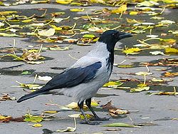
Deer, coyote, rabbit, hare, squirrel, fox, armadillo, badger, opossum, black vulture, crow, and other minor species inhabit this region.