Toompea
The late Iron Age fortified settlement did not probably have permanent inhabitants, but was rather seasonally used for protecting the harbour and its adjacent marketplace.
[8] The exact location of the stronghold is not known, but it is presumed that it occupied only a small portion of Toompea, either its then-highest point a bit southeast of today's cathedral[9] or the northern end of the hill.
In the second half of the 13th century Toompea (the Great Castle) was surrounded with a wall by the hill's perimeter, built mainly by vassals who owned the plots there.
[15] Beginning from the same period Toompea started to develop into the centre of provincial authority, clergy and nobility in Northern Estonia.
[16] Most of the vassals chose Toompea for their residence – living in their estates in the conquered countryside was deemed too dangerous; by the end of the 13th century the Great Castle was densely populated.
[18] In the aftermath of the St. George's Night Uprising, in 1346 Denmark sold its possessions in Northern Estonia and followed 215 years under the rule of the Livonian Order.
That area, located southwest of the hill and where the suburbs (Vorstadt) of Toompea (Tõnismäe, Kassisaba and Kelmiküla) were built during subsequent periods, was called "Dome territory" until the 20th century.
When Tallinn capitulated to Eric XIV of Sweden in 1561, the king decided not to change the status quo in the relations between Toompea and Lower Town.
[23] Toompea, as a separate town (Dom zu Reval) under its own administration was able to retain a variety of special rights and privileges, the last of which remained in the books until 1889.
[29] Following the Great Northern War and the conquest of Estonia by the Russian Empire, the first half of the 18th century was a period of general neglect for Toompea and also for the castle, which fell into disuse for several decades.
[29] The situation changed in the second half of the 18th century: in 1767-1773 the east wing of the castle was completely rebuilt into an administrative building of the Governorate of Estonia by the orders of Catherine II.
[33] The general look of Toompea changed greatly when the architecturally completely different Russian Orthodox Alexander Nevsky Cathedral was built in 1894-1900.
[34] The cathedral, situated on the Castle Square in front of the Toompea Palace, was erected during the period of Russification as a symbol of the czarist rule and Russian dominance.
Due to its very prominent location and an immediately recognizable Russian style the cathedral garnered opposition already during the time it was built and in the end of the 1920s and 1930s, in the independent Republic of Estonia, there were even proposals to demolish it.
[35] In 1903, when the Patkuli stairs were built near the northern end of the hill, Toompea got a new access from the direction of the main railway station of Tallinn.
The facade of the classicist governor's palace dominates Lossi plats ("Castle square"), where the Orthodox Alexander Nevsky Cathedral overtops it.
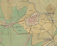
A separate relic klint island, Toompea lies about 1.5 km northwest of the North Estonian Limestone Plateau.
From the east, north and west Toompea is bordered for 1.5 km by a cliff with a height of up to 25 m. The southern slope of the hill descends more gently.