Trimble County, Kentucky
The county is largely divided into two by a central roughly north–south ridge; to the east of which lie the Little Kentucky River and Daughtery, Buck, and Carmen Creeks; and to the west of which lie Spring, Corn, Middle, Patton's and Barebone Creeks, tributaries of the Ohio River.
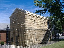
[7] and is located on 2,200 acres situated along the Ohio River, 50 miles northeast of Louisville.
Trimble county comprises two major towns, a couple of hamlets, and various small settlements.
[17] The 1877 Collins county history identified the towns of Bedford, Milton, Kingston, and Palmyra.
[18] Its environs include Callis Grove, to the north, the site of an open-air tabernacle and campgrounds built by a Methodist church, retaining the name of the old Callis Grove post office run by Robert Edward Callis from June 1893 to September 1894 at the junction of what is now U.S. highway 42 and New Hope Road;[19] and Bedford Springs, a set of springs popular before the U.S. Civil War.
[22] In its vicinity are such things as Lookout Point[20] and the erstwhile farm of Delia Webster.
The rest of the county was in the 19th century a wide number of very small settlements, characterized as "just 'store-school-church' crossroads" by geographer Nancy Demaree.
[24] They are Wises Landing and Corn Creek, counting as two for this purpose despite their historic conflation, Abbott/Abbotsford, which also may not actually have been separate places, and Providence.
[25] Abbotsford post office from the name was at a "ford" somewhere on the Little Kentucky River, or possibly another watercourse, in the store and hotel of postmaster James Abbot.
[25] The first Abbot post office (1880-08-02 to June 1883) was in postmaster Madison Dunn's home north of the Little Kentucky River.
[26] It was actually identified on maps as Hammel until World War One, after which it was apparently renamed Providence after a local Baptist church.