1979 Atlantic hurricane season
Two days later, Tropical Depression One formed and produced severe flooding in Jamaica, with 41 deaths and about $27 million (1979 USD) in damage.
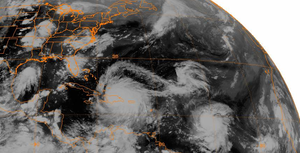
Hurricane Bob spawned tornadoes and produced minor wind damage along the Gulf Coast of the United States, primarily in Louisiana, while the remnants caused flooding, especially in Indiana.
Tropical Storm Claudette caused extensive flooding in Texas due to torrential rainfall, resulting in two deaths and about $750 million in damage.
Hurricane Henri remained offshore in the Gulf of Mexico and disrupted efforts to stop the Ixtoc I oil spill.
[7][3] Early on June 14, the depression emerged into the western Atlantic Ocean and then moved parallel to the east coast of Florida for a few days.
[3] The slow movement of the depression to the west of Jamaica resulted in torrential rainfall, peaking at 32 in (810 mm) in Friendship, a city in Westmoreland Parish.
It headed westward and after satellite imagery indicated a closed circulation, the wave was classified as a tropical depression on June 19, while located several hundred miles east-southeast of the Windward Islands.
[16] A United States Air Force reconnaissance aircraft noted that the depression was strengthening and by early on June 22, it was upgraded to Tropical Storm Ana.
Rainfall exceeding 10 inches (250 mm) in some areas of Puerto Rico led to widespread agricultural damage, flooded homes and streets.
[22] Up to 42 inches (1,100 mm) of rain fell in one day in Alvin, Texas, which is the record 24‑hour precipitation amount for any location in the United States.
[7] In Louisiana, extensive coastal flooding occurred, with miles of roads battered or destroyed in Cameron Parish, while several boats along the coast capsized.
After entering the Caribbean Sea, further deepening occurred and at 18:00 UTC on August 30, David peaked with maximum sustained winds of 175 mph (280 km/h).
Moving northwestward, David made landfall in the eastern tip of Cuba that day and briefly weakened to a tropical storm.
[7] In Florida, strong winds left moderate damage, including a downed radio tower, snapping a crane, and deroofing buildings.
[3] However, on August 28, a ridge of high pressure forced the system to move west-southwestward,[29] causing it make landfall in a rural area of Tamaulipas later that day.
[3] The depression brought heavy rainfall to some areas of Mexico, with 18.94 in (481 mm) of precipitation observed in Santa María Xadani, Oaxaca.
[29] Satellite imagery and ship observations indicated that a tropical depression developed at 06:00 UTC on August 29, while located about 270 mi (430 km) south-southwest of the southernmost island of Cape Verde.
[30] After crossing Puerto Rico, Frederic briefly re-emerged into the Caribbean Sea, before making landfall near Santo Domingo, Dominican Republic with winds of 45 mph (75 km/h) at 00:00 UTC on September 6.
[3] Minimal impact was reported in that country, though heavy rainfall, exceeding 24 in (610 mm) in some places, compounded damage inflicted by Hurricane David.
At 12:00 UTC on September 12, Frederic attained its peak intensity with maximum sustained winds of 130 mph (215 km/h) and a minimum barometric pressure of 943 mbar (27.8 inHg).
Upon reaching the central Gulf of Mexico, ships, buoys, and satellite observations indicated that a tropical depression developed early on August 30,[7][3] while located about halfway between the southeastern tip of Louisiana and the north coast of the Yucatán Peninsula.
[3] A higher latitude frontal system and a high pressure area caused Gloria to decelerate and resulted in a westward motion beginning on September 9.
At 1800 UTC on September 12, Gloria attained its peak intensity with winds of 100 mph (155 km/h) and a minimum barometric pressure of 975 mbar (28.8 inHg).
[3] During that time, Gloria slowly began merging with a low pressure area that was located north of the Azores and lost tropical characteristics by September 15.
Henri turned east-northeastward on September 23 and was absorbed by a frontal low pressure trough in the east-central Gulf of Mexico on the following day.
[34] Although it remained offshore, the storm brought heavy rainfall to Mexico, peaking at 19.59 inches (498 mm),[35] forcing at least 2,000 people from their homes in Ciudad del Carmen, Campeche.
[36] This system formed as a non-tropical low within a pre-existing area of heavy thunderstorms along a stationary front on September 19 off the coast of Brownsville, Texas.
Portions of western Louisiana experienced 10 to 17 in (250 to 430 mm), resulting in severe flooding, with the worst impacted parishes being Allen, Calcasieu, and Rapides.
It turned east, passing south of Bermuda early on the morning of July 13 while accelerating eastward, with the depression dissipating that afternoon.
The depression made landfall on the southeastern tip of Newfoundland on August 5 after passing southeast of Nova Scotia earlier that day.