U.S. Route 40 in New Jersey
The road heads southeast into Salem County as an eight-lane freeway maintained by the Delaware River and Bay Authority that passes through industrial areas.
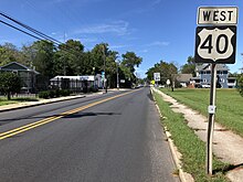
[1][2] It continues into rural areas consisting of woods, farms, and residences, heading farther to the south of the New Jersey Turnpike.
[2] Upon meeting the eastern terminus of Route 48, US 40 turns to the southeast and becomes the Harding Highway, a two-lane undivided road that passes through more agricultural areas.
At this point, US 40 turns to the northeast to run concurrent on Route 45 and enters Woodstown, where it becomes West Avenue and passes residences before reaching the downtown area.
The route crosses from Woodstown into Pilesgrove Township again, where it turns east-southeast as Harding Highway and heads back into a mix of fields and woods amid homes.
After passing over Conrail Shared Assets Operations' (CSAO) Vineland Secondary railroad line, US 40 and Route 47 split.
[1][2] Immediately after CR 557 joins US 40, the road enters Buena, Atlantic County and continues southeast into inhabited areas.
[1][2] At this point, it enters Buena Vista Township, and CR 557 splits form US 40 by heading to the southeast on Buena-Tuckahoe Road.
Upon leaving Richland, the route crosses into Hamilton Township, where it runs through Mizpah before heading back into forested areas and a few residential sectors.
US 40 intersects the eastern terminus of CR 552, briefly becoming a divided highway before turning east into denser inhabited areas.
[1] The route passes more wooded residential and commercial areas, as well as the Storybook Land amusement park, before intersecting CR 563.
CR 563 splits from the road by continuing southeast and the Black Horse Pike heads east interchange with the Garden State Parkway.
[1][2] The only direct ramp present is between the Black Horse Pike westbound and the Garden State Parkway northbound; all other movements are provided by CR 563.
Here, the name becomes Albany Avenue and it comes to a pair of ramps that provide access to and from the Black Horse Pike eastbound and the Atlantic City Expressway westbound.
Past this bridge, the road passes between businesses to the west and the closed Bader Field airport and Surf Stadium to the east.
[16][17] In the 1980s, Congressman William J. Hughes proposed a freeway along the US 40 corridor in order to alleviate increased traffic along that route following the legalization of gambling in Atlantic City.
This freeway, which was to be maintained by the New Jersey Expressway Authority, was to run from the Delaware Memorial Bridge east to Atlantic City.
[21] Due to frequent flooding in Atlantic County, NJDOT announced in 2019 a plan to reconstruct and raise a one-mile portion of the roadway from Naples Avenue to Bayport Drive in Egg Harbor Township by 2.5 ft (0.76 m).