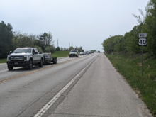
U.S. Route 40
Starting at its western terminus in Utah, US 40 crosses a total of 12 states, including Colorado, Kansas, Missouri, Illinois, Indiana, Ohio, West Virginia, Pennsylvania, Maryland, Delaware, and New Jersey.
The National Road was created in 1806 by an act of Congress to serve as the first federally funded highway construction project.
The Victory Highway was designated as a memorial to World War I veterans and ran from Kansas City, Missouri to San Francisco.
US 40 is a limited access highway from the I-80 junction to its intersection with Utah State Route 32 (SR-32), approximately 13 miles (21 km) south of Park City.
At the west side of Lawrence, the route is joined by K-10 and travels south and east to the junction with US 59 and then runs north with US 59 to cross the Kansas River.
Before this date, US 40 and US 24 continued along State Avenue to College Parkway before turning right to follow Turner Diagonal for 1⁄2 mile (800 m) where US 40 joined Interstate 70 for the duration of its journey eastward toward Missouri.
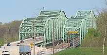
From Wentzville, US 40 now joins a concurrency with I-64 and US 61 and heads southeast, crossing the Missouri River again over the Daniel Boone Bridge in St. Charles.
Some early bypasses of towns were built with the apparent intention of twinning them as a divided highway with access limited to intersections.
From Vandalia, the road continues to the northeast passing through the early German settlement town of Teutopolis and several city streets in Effingham.
The road continues to the northeast beyond Harmony, passing many unincorporated places such as Reelsville, Pleasant Gardens, Manhattan, Putnamville, Mount Meridian, Stilesville and Belleville along the way to Plainfield, a suburb of Indianapolis.
(Previously, the highway did not join with I-465 but continued along Washington Street, where it entered Indianapolis proper near Eagle Creek, a tributary of the White River.
The new alignment diverts at White River Parkway W. Drive and rejoins the original route at the Indiana State Museum; the length of US 40 replaced is about .9 of a mile.
In Vandalia, the road passes to the south of Dayton International Airport and crosses the Dixie Highway and I-75 and the Great Miami River.
[9][21] The portion of US 40 between Medway-Carlisle Road (Ohio State Route 571/County Road 303) and Lammes Lane in Bethel Township, Clark County, is designated "Staff Sergeant Wesley Williams Memorial Highway",[22] in honor of a 2005 Tecumseh High School graduate who died on December 10, 2012, while serving in the U.S. Army, from injuries suffered when enemy forces attacked his unit with an improvised explosive device in Kandahar Province, Afghanistan.
From Tuttle Road just east of Springfield to state route 54 in South Vienna US 40 has been designated as the Deputy Matthew Yates Memorial Highway.
[9][21] East of the Columbus metro area, US 40 parallels I-70 at a distance of about 1-mile (2 km), passing through several small towns, including Kirkersville, and Hebron.
Routes 22 and 40 enter Cambridge from the southwest along John Glenn Highway, and split in town; US 40 follows Wheeling Avenue.
US 40 is only 16 miles (26 km) long as it passes through West Virginia, mainly through Wheeling, where it briefly runs concurrent with both I-70 and US Route 250.
It closely parallels I-70 from West Virginia until it reaches Washington where it follows Chestnut St, Jefferson Avenue and Maiden Street.
A short limited access highway in California and West Brownsville provides an approach to the Lane Bane Bridge across the Monongahela River.
The two routes closely follow the course of the Chesapeake and Ohio Canal and the Potomac River for several miles before US 40 leaves the Interstate at exit 9.
US 40 parallels I-70, its longtime travel partner, crossing it at exit 32 near Greenbrier State Park on the Baltimore National Pike alignment.
US 40 Alt heads southeast on the Old National Pike alignment through Boonsboro, crossing South Mountain at Turner's Gap.
[27] After crossing the Jones Falls Expressway (I-83), US 40 follows Orleans Street, and finally becomes the Pulaski Highway as it leaves Baltimore to the northeast.
[9][28] US 40 enters the borough of Woodstown as a concurrency with Route 45 along West Avenue; it leaves town heading southeast.
[31] In 1755, during the French and Indian Wars, General Edward Braddock blazed a trail en route to capture Fort Duquesne (modern Pittsburgh, Pennsylvania).
[11] In 1806, Thomas Jefferson signed into law an act of Congress establishing a National Road to connect the waters of the Atlantic Ocean with the Ohio River.
[35] Most of the western section of US 40 follows the former route of Victory Highway, a road that once linked Kansas City to San Francisco.
[36][37] According to a 1926 guide published about the Victory Highway, it was the fastest route between San Francisco and Salt Lake City, allowing travellers to complete the 784-mile (1,262 km) trip "comfortably and in high gear in from 3 to 4 days.
In rural Nevada the highway forms the business loops for Wadsworth, Fernley, Lovelock, Winnemucca, Battle Mountain, Carlin, Elko, and West Wendover.