U.S. Route 80 in Arizona
Like its northern counterpart, US 66, the popularity of travel along US 80 helped lead to the establishment of many unique roadside businesses and attractions, including many iconic motor hotels and restaurants.
Tourism and traffic along US 80 greatly increased following the end of World War II, creating a temporary economic boom for businesses along the highway.
The remaining stand-alone sections of US 80 in Arizona, not concurrent with other highways, were re-designated as State Route 80, a northern extension of SR 85 and various Interstate business loops.
After heading north a short distance, the highway turned northeast near Palo Verde Nuclear Generating Station and passed through Arlington.
Both highways passed through the town of Oro Valley on the western side of the Santa Catalina Mountains before crossing the El Rillito river into Tucson.
[1][2][6][10] Benson Highway has a row of neon-signed motels that stretch southeast out of Tucson towards Vail, including the iconic Spanish Trail Inn, which now stands partially abandoned.
Just across the county line, US 80 made a small curve onto Titan Drive, crossing under the now-abandoned El Paso and Southwestern Railroad before returning once again to the route of I-10.
US 80 then passed under the El Paso and Southwestern Railroad, meeting SR 92 at its eastern terminus before running northeast of Warren through Grace Corner towards the Mexican border.
[1][2][6][11] Near the border, US 80 turned directly east, meeting the southern terminus of US 666 before crossing under the El Paso and Southwestern Railroad again, heading into Douglas, Arizona.
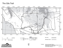
The first non-Native person to travel the Gila Trail was a Spanish-owned African slave named Esteban, who had been brought to North America in 1527 as part of the colonization of Florida by Charles V of Spain.
[21] Following the Mexican-American War, the Treaty of Guadalupe Hidalgo in 1848 and the Gadsden Purchase in 1853, the land surrounding the Gila Trail became part of the United States and was organized as New Mexico Territory in 1850.
The new name was in reference to Captain Philip St. George Cooke, leader of the Mormon Battalion, whom had used the road shortly after General Kearny.
The Arizona State Highway Department (ASHD) decided to construct a new alignment further south, following the Southern Pacific Railroad more closely through Gila Bend.
[25] On November 11, 1926, the American Association of State Highway Officials (AASHO) approved of the new system, which included U.S. Route 80 between Savannah and San Diego.
[48] Further aid on US 80 was supplied by the Works Progress Administration (WPA), which provided the state with extra funding and a labor force to reconstruct the highway.
Williamson aimed to rebuild a large section of US 80 and US 89 north of downtown, as well as a small segment of SR 84, into a thriving commercial district.
Originally, the glorified roadway along the three highways was to be named "Parkway Boulevard" but Williamson decided instead to call the proposed district Miracle Mile after its inspiration.
[25] On October 12, 1940, Hollywood cowboy western actor Tom Mix left the Oracle Junction Inn at the intersection of US 80, US 89 and SR 77, heading north by car on US 80 and US 89 towards Florence.
Later that same day, Mix lost control of his vehicle on the unpaved road and was killed instantly when his car crashed into an unfinished wash bridge just south of Florence.
In response, the proponents voted to form a California, Arizona and New Mexico division of the U.S. Highway 80 Association to better promote US 80 to cross country tourists.
The division committed itself to publishing thousands of informational booklets, strip maps and pay for roadside advertisements all in an effort to promote the highway.
Corral in Tombstone, Stoval's Space Age Lodge in Gila Bend, Yuma Territorial Prison, the Geronimo Surrender Monument near Douglas and the Painted Rock Petroglyph Site.
High demand for motel rooms by U.S. Army personnel and the postwar population boom in Tucson resulted in an explosive growth of hotel and restaurant construction on Miracle Mile and Benson Highway southeast of downtown.
Two new bridges had to be constructed over Ciénega Creek and Davidson Wash as well as an underpass to allow the new section of US 80 to travel underneath the Southern Pacific Railroad.
[65][66] Originally constructed as a wagon road in December 1881 and becoming a paved auto highway by the 1920s, the older route of US 80 over Mule Pass (also known as the Old Divide) provided a dangerous obstacle for vehicles heading into Bisbee.
[67][68] In April 1955, the Arizona State Highway Department began studying the feasibility of constructing a tunnel to bypass the older route of US 80 over the Old Divide.
[65] In January 1957, the Arizona State Auditor, Jewel Jordan, rejected the contractor's first claim for $15,000 ($124,427 in 2023) in payment regarding tunnel work completed up to that point.
The American Association of State Highway and Transportation Officials (AASHTO) approved the request, allowing ADOT remove the designation between Yuma and Benson on September 16.
[17] The proposal included several attached letters of support from various historical committees, mayors and city council members of several towns which the designation would affect.
Currently, ADOT is also working with respective local governing bodies to sign and designate the segments that are no longer part of the state highway system.