Uele District
[1] The French colonies were to the north of the district and the British-controlled Lado Enclave to the east, on the west bank of the Nile.
[1] A 1956 description of the district said the north of Uele is covered with shrub savannas interspersed with galleries and fragments of forest.
The conversions were not always sincere, but some took the religion very seriously and abstained from alcohol, fasted during Ramadan, prayed and adopted Arabic dress.
Around 1880 many Azande chiefs placed themselves at the disposal of the Egyptians, who were represented by Europeans such as Frank Lupton and Romolo Gessi, in part to fight the slavers.
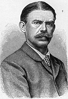
[10] By 1896 King Leopold II of Belgium was becoming concerned that instability in the Bahr al-Ghazal would affect his Congo Free State, and that Sudanese slavers would penetrate further south and join up with the Arab and Swahili traders at Stanley Falls.
[10] Leopold's decree of 1 August 1888 divided the Congo Free State into eleven districts, including Aruwimi-Uele with its headquarters in Basoko.
[12] He was also told to "exploit the ivory of the state domain", and his journal includes many details of tusks he bought or was given by chiefs along the Ubangi, M'bomu and Uele rivers.
In 1891 Guillaume Van Kerkhoven, Pierre Ponthier [fr] and Jules Milz followed the same route to the Uele, then explored the Kibali and the Zoro.
He was instructed to ensure that all the ivory and rubber of the sultanates of the M’bomu region was paid as tribute to the Free State.
[13] By 1892 the Belgians were taking drastic action to prevent ivory and rubber from being smuggled across the M'Bomu to French Territory.
[16] The Uele was clearly a natural defensive line for the north of the Congo Free State, and the forests along it would provide a source of food.
Posts included Yakoma in the Ubangi District, Djabir, Libokwa, Bambili, Surango, Niangara, Dungu and Faradje.
Later these posts were connected by the first road in the Congo Free State that could be used by motor vehicles, which was extended from Faradje to the Nile by way of Yei and Loka in the savannah zone.
[15] The two posts of Yei and Loka were established to the northeast of Faradje in the arid Lado Enclave on the Nile, leased from the British.
[15] The Belgian expeditions caused a dispute with the French that led to an agreement that the Bomu would be the northern border of the Congo Free State in this region.
[14] In 1895 Jules Joseph La Haye was charged with building the Bomokandi post on the rocky right bank of the Uele River.
[22] The administration responded to an epidemic of sleeping sickness that began in 1904 in the Congo Free State with measures that had been proven against cholera and plague in Europe.
[23] The director of Ibembo lazaret made several proposals between 1907 and 1912 for a program to contain sleeping sickness in the "great uninfected triangle" of the Uele.
[27] During the colonial era a railway was constructed through the region from east to west, on which the agricultural road network converged.
The territories were Bondo, Ango, Dungu, Manbetu (headquarters in Paulis), Buta, Aketi, Poko and Niangara.