Volcanism of the Mount Edziza volcanic complex
Three distinct periods of eruptive activity also characterized the second magmatic cycle between 6 and 1 million years ago; they are represented by the Nido, Spectrum and Pyramid geological formations.
The third magmatic cycle about 1 million years ago is represented by the Ice Peak, Pillow Ridge and Edziza geological formations, each of which is also the product of a distinct eruptive period.
Three distinct periods of eruptive activity also characterized the fourth magmatic cycle between 0.8 and 0.2 million years ago which are represented by the Arctic Lake, Klastline and Kakiddi geological formations.
[8][13][14] A northerly-trending, elliptical, shield volcano consisting of multiple flat-lying lava flows forms the plateau which is capped with several smaller volcanic structures of the complex.
[16][17] After Level Mountain, the MEVC is the largest eruptive centre in the Northern Cordilleran Volcanic Province which extends from northwestern British Columbia northwards through Yukon into easternmost Alaska.
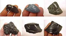
[7][23] Peralkaline volcanism with similar chemistry, mineralogy and isotopic composition has also occurred at the Rainbow Range in central British Columbia, as well as at the Afar Triangle in East Africa and in the Great Basin of western North America.
[27] Volcanism of the MEVC has taken place during five cycles of magmatic activity in the last 8 million years, each of which began with the effusion of alkali basalt and culminated with the eruption of felsic magma.
[4][41] Subsequent eruptions of the Little Iskut shield volcano produced thick, irregular, randomly jointed lava flows that travelled down its gentle eastern, southern and western flanks.
[6][47] It began with explosive activity from a vent at Cartoona Ridge which produced 10-kilometre-long (6.2-mile) ash flows and an air-fall pumice deposit that covers an area of several hundred square kilometres.
[60] The lava flows are mineralogically and geomorphologically similar to those of the Raspberry Formation, having buried lag gravels and travelled into valleys where they disrupted the drainage system to form lava-dammed lakes.
[6] A relatively small initial eruption of pumice and ash was followed by the effusion of massive rhyolite flows, each up to 150 metres (490 feet) thick and 13 kilometres (8.1 miles) long.
Erosional remnants of Kitsu Member alkali basalt flows cap the higher summits of the Spectrum Range where they overlie the unmodified upper surface of the original dome.
[77] The original dome was higher in elevation as evidenced by the thick, gently dipping trachyte flows forming the 2,430-metre-high (7,972-foot) summit of Kitsu Peak, the highest point of the Spectrum Range.
[80] This short period of basaltic volcanism was followed by the extrusion of felsic flows and domes forming The Pyramid, a pyramid-shaped mound on the northeastern flank of Mount Edziza.
[89] A wide variety of volcanic rocks comprise the Ice Peak Formation, including alkali basalt, hawaiite, trachybasalt, tristanite, mugearite, benmoreite and trachyte.
Volcanism initially began on the southern flank of Sphinx Dome where pyroclastic material mixed with meltwater from residual ice to produce highly mobile debris flows and lahars.
[98] These dates being older than those of the Pyramid eruptive period may be due to excess argon in Ice Peak rocks and are therefore considered unreliable; the true age is estimated to be about 1 million years.
[99][100] Two thick lobes of trachyte lava issued from satellitic domes on the western flank of Ice Peak during this eruptive period, both of which were deposited onto the Big Raven Plateau.
[93] This feature eventually grew above the level of the meltwater pond to produce subaerial lava fountains which formed a relatively steep-sided pyroclastic cone on top of the tuff ring.
[129] The third eruptive period produced thick trachyte flows and pyroclastic rocks of the Kakiddi Formation which occupy valleys on the eastern flank of Ice Peak.
[38][135] The third volcano, Source Hill, is a cinder cone that was created about 3 kilometres (1.9 miles) to the northwest during a massive eruption of lava when only the central part of the Arctic Lake Plateau contained a thin lobe of glacial ice.
[114][6] Alkali basalt of this eruptive period mainly rests on Mesozoic and Paleozoic rocks of the Stikinia terrane, although it also locally overlies rhyolite of the Spectrum Formation.
[139][140] The Klastline eruptive period 0.62 million years ago was characterized by minor lava fountaining and the effusion of massive basalt flows from at least three vents along the northern flank of Mount Edziza.
[150] Minor tristanite and a relatively small but thick trachyte flow issued from a vent on the western flank of Ice Peak where it advanced onto the Big Raven Plateau.
[38][121][151] Breccia and spatter agglutinated around the vent area to create Punch Cone, a roughly 1-kilometre-long (0.62-mile), steep-sided ridge projecting through Mount Edziza's ice cap.
[163] Radiocarbon dating of terrestrial plant macrofossils directly overlying the youngest tephra layer suggest an Early Holocene age for this volcanic material.
[154] Cinder Cliff in the northern fork of Tenchen Creek valley formed when an eruption of basaltic magma ponded against an ice dam and engulfed debris such as moraine and talus.
[170] The youngest cinder cone, The Ash Pit, formed at the south end of the Mess Lake Lava Field on the northern side of Nagha Creek.
[177] Two small Big Raven cinder cones formed in Walkout Creek valley about 18 kilometres (11 miles) southwest of Mount Edziza, both of which produced basaltic lava flows.
[197][198] Glacial sediment under a 0.3-million-year-old basalt flow of the Klastline Formation in the Stikine River valley corresponds with marine isotope stage 10 of the Middle Pleistocene.