Waldo, Kansas
A small business community, including a bank, stores, and three grain elevators, developed during the 1900s.
[4] The town served as an agricultural shipping and receiving point for the surrounding area.
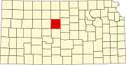
[7][8] Located in the Smoky Hills region of the Great Plains, Waldo sits on the east bank of the West Fork of Wolf Creek, part of the Saline River watershed.
[7] According to the United States Census Bureau, the city has a total area of 0.36 square miles (0.93 km2), all land.
53.3% of all households were made up of individuals, and 60.0% had someone living alone who was 65 years of age or older.
The racial makeup of the city was 95.83% White, 2.08% Native American, and 2.08% from two or more races.
44.4% of all households were made up of individuals, and 18.5% had someone living alone who was 65 years of age or older.
The three industries employing the largest percentages of the working civilian labor force were: agriculture, forestry, fishing and hunting, and mining (40.0%); educational services, and health care and social assistance (30.0%); and retail trade (20.0%).
The city council consists of five members, and it meets on the first Tuesday of each month.
[13] The community is served by Natoma–Paradise–Waldo USD 399 public school district, which is located in Natoma.
[16] U.S. Route 281 and Kansas Highway 18 (K-18) run concurrently east–west through Waldo.