Weather of 2020
As 2020 began, sea surface temperatures were above normal in the eastern Pacific Ocean near the equator, which had the potential to develop into El Niño conditions.
On January 9, a group of climate scientists writing for ENSO Blog published their forecast for atmospheric conditions.
Trade winds were enhanced in the central and tropical Pacific Ocean, and water temperatures remained above normal.
[2] However, the sea surface temperatures near the equatorial pacific began to cool well below average, indicating a developing La Niña.
[3] In September, NOAA confirmed that the environment shifted to a La Niña pattern, based on lower than normal water temperatures in the eastern Pacific Ocean near the equator.
The ENSO Blog estimated a 75% chance that La Niña conditions would persist through the end of the year, in part due to a strengthening Walker circulation.
In January, a subtropical storm named Kurumĺ caused heavy rainfall in southeast region of Brazil.
The highest rainfall occurred in the state Minas Gerais's capital Belo Horizonte.
It initially started in November last year, but the flood continued in isolated regions during December and January.
The Bush Fire burned across Arizona for several days, becoming the fifth largest ever recorded in the state.
For the first time in history, there were no tornadoes in the National Weather Service Wichita, Kansas coverage zone.
Tornadoes in the Southeastern United States killed 7 people,[23] and caused $1.1 billion in damage.
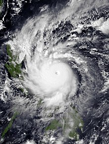
Of these, 104 were named, including a subtropical cyclone in the South Atlantic Ocean, by various weather agencies when they attained maximum sustained winds of 35 knots (65 km/h, 40 mph).
The deadliest and costliest storm of the year was also Cyclone Amphan, causing over 100 fatalities in India, Sri Lanka, and Bangladesh.
In November, powerful hurricanes Eta and Iota struck Central America within a two week period, resulting in significant damage and loss of life.
After Nisarga dissipated, there was no activity between June 4 and October 11 – one of the longest gaps in inactivity on record.
Gati later became a Category 3 tropical cyclone on the Saffir-Simpson Hurricane Wind Scale, and made landfall in the Horn of Africa near Ras Hafun which became later the strongest cyclone to make a landfall Somalia since reliable records began in 1891.
Two more storms formed in the Bay of Bengal – Nivar and Burevi, both impacting South India.
Burevi formed on November 30, and made a landfall in North Sri Lanka, but it stalled near Comorin and dissipated.