White Pine Range
To the west of the range are the Duckwater (Shoshone) tribal lands and the northern arm of large Railroad Valley.
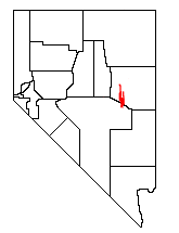
[3] U.S. Route 50, the "Loneliest Road in America", crosses the range near its northern end at Little Antelope Summit (7,433 ft; 2,266 m).
The historic mining area of Hamilton lies just south of Highway 50 and includes Mt.
This high section of the range is protected as the Currant Mountain Wilderness Area, and its eastern slopes serve as headwaters to the White River.
Young and old trees alike exist at elevations above 10,000 feet, right up to the summit of Currant Mountain.