Wouri River
The Wouri forms at the confluence of the rivers Nkam and Makombé, 32 km (20 mi) northeast of the city of Yabassi.
It then flows about 160 km (99 mi) southeast to the Wouri estuary at Douala, the chief port and industrial city in the southwestern part of Cameroon on the Gulf of Guinea.
The explorers noted an abundance of the mud lobster Lepidophthalmus turneranus in the Wouri River and named it "Rio dos Camarões", Portuguese for "River of Prawns", and the phrase from which the name Cameroon derived.
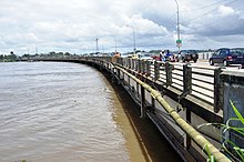
[1] In the 1950s, during the colonial period, the French built a bridge of 1 km across the river, the longest in the central African sub-region.
It connects Douala with the city of Bonabéri and is not only of great economic importance to western Cameroon, carrying auto, truck, and train traffic but also a central tool for international exchanges with landlocked countries like Chad and the Central African Republic.