Annapolis River
Measuring 120 kilometres in length,[2] the river flows southwest through the western part of the valley from its source in Caribou Bog (50 m [160 ft] above sea level) near the villages of Aylesford and Berwick in western Kings County, to its mouth near Clementsport where it empties into the Annapolis Basin.
The estuary portion of the Annapolis River runs from Bridgetown to near Clementsport and experiences a tidal range of approximately 7.5 m (25 ft) between tides.
The eastern part of the Annapolis Valley is drained by the Cornwallis River, also rising in the Caribou Bog, which has been dated to 10,000 years old.
The comparatively mild micro-climate produced by the valley's North and South mountain ranges, as well as its proximity to the waters of the Bay of Fundy make the region ideal for fruit crops such as apples.
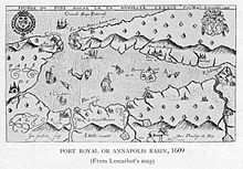
After France relinquished the part of Acadia which is now peninsular Nova Scotia to Britain in 1713, Annapolis Royal became the capital of the British colony of Nova Scotia until 1749; Fort Anne was established at the mouth of Allains Creek where it drains into the river to protect the community from attack.