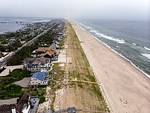
Barrier island
A barrier chain may extend for hundreds of kilometers, with islands periodically separated by tidal inlets.
In terms of coastal morphodynamics, it acts similarly to a naturally occurring barrier island by dissipating and reducing the energy of the waves and currents striking the coast.
The difference is that dunes on a barrier island typically contain coastal vegetation roots and marine bioturbation.
They occur primarily in areas that are tectonically stable, such as "trailing edge coasts" facing (moving away from) ocean ridges formed by divergent boundaries of tectonic plates, and around smaller marine basins such as the Mediterranean Sea and the Gulf of Mexico.
[7] Areas with relatively small tides and ample sand supply favor barrier island formation.
The term "critical width concept" has been discussed with reference to barrier islands, overwash, and washover deposits since the 1970s.
The only process that widened the barrier beyond the critical width was breaching, formation of a partially subaerial flood shoal, and subsequent inlet closure.
[4] No single theory can explain the development of all barriers, which are distributed extensively along the world's coastlines.
Barrier island systems develop most easily on wave-dominated coasts with a small to moderate tidal range.
It is especially important for sea level to remain relatively unchanged during barrier island formation and growth.
If sea level changes are too drastic, time will be insufficient for wave action to accumulate sand into a dune, which will eventually become a barrier island through aggradation.
The formation of barrier islands requires a constant sea level so that waves can concentrate the sand into one location.
As the bars developed vertically, they gradually rose above sea level, forming barrier islands.
[17] American geologist Grove Karl Gilbert first argued in 1885 that the barrier sediments came from longshore sources.
He proposed that sediment moving in the breaker zone through agitation by waves in longshore drift would construct spits extending from headlands parallel to the coast.
[20] Along the coast of Louisiana, former lobes of the Mississippi River delta have been reworked by wave action, forming beach ridge complexes.
Prolonged sinking of the marshes behind the barriers has converted these former vegetated wetlands to open-water areas.
In a period of 125 years, from 1853 to 1978, two small semi-protected bays behind the barrier developed as the large water body of Lake Pelto, leading to Isles Dernieres's detachment from the mainland.
[14] An unusual natural structure in New Zealand may give clues to the formation processes of barrier islands.
The Boulder Bank, at the entrance to Nelson Haven at the northern end of the South Island, is a unique 13 km-long stretch of rocky substrate a few metres in width.
Wave-dominated barrier islands are long, low, and narrow, and usually are bounded by unstable inlets at either end.
Longshore currents, and the resultant extension, are usually in one direction, but in some circumstances the currents and extensions can occur towards both ends of the island (as occurs on Anclote Key, Three Rooker Bar, and Sand Key, on the Gulf Coast of Florida).
Older barrier islands that have accumulated dunes are less subject to washovers and opening of inlets.
Wave-dominated islands require an abundant supply of sediment to grow and develop dunes.
Ebb shoals refract waves approaching the inlet, locally reversing the longshore current moving sand along the coast.
This process captures sand that is carried by the longshore current, preventing it from reaching the downcurrent side of the inlet, starving that island.
[23] Many of the Sea Islands in the U.S. state of Georgia are relatively wide compared to their shore-parallel length.
Siesta Key, Florida has a characteristic drumstick shape, with a wide portion at the northern end near the mouth of Phillipi Creek.
Multiple wetland systems such as lagoons, estuaries, and/or marshes can result from such conditions depending on the surroundings.