Buenaventura River
[1] In 1776, two Franciscan missionaries Atanasio Domínguez and Silvestre Vélez de Escalante sought to find a land route between Santa Fe in Nuevo México to Monterey in Alta California.
[b] On September 13, they encountered what is now called the Green River in modern day Utah, a southward-flowing tributary of the Colorado and named it San Buenaventura after the catholic saint Bonaventure.
The Sevier Lake has no outlet, so the indigenes may have been referring to the west-flowing Humboldt River, which originates over 150 miles northwest, and were misinterpreted by the explorers.
[15] So, when, in 1841, John Bidwell embarked over the Rocky Mountains to California, he was advised to take carpenters tools with them, to build canoes and sail from the GSL to the Pacific.
[16] There had long been a hope that a river flowing west from the Rocky Mountains to the Pacific Ocean would provide an easy route for travel and trade.
Then, when Manuel Augustin Mascaro and Miguel Constanso made the first map of the whole Viceroyalty of New Spain (1784), they extended the "San Felipe" almost to the Sevier Lake.
[18] A similar map was published in 1820 by Sidney E. Morse showing the Rio de San Buenaventura flowing into a lake, the western limits of which are unknown.
[citation needed] Other cartographers began to boldly assert that rivers flowed from Lake Timpanogos and "Lac Salado" to the Pacific Ocean.
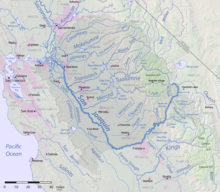
Henry S. Tanner's influential map of 1822 shows the Buenaventura River flowing from the north central Rockies through the Sevier Lake to the Pacific Ocean south of Monterey Bay.
The Great Salt Lake (GSL) was first seen and reported as very saline by white North Americans in 1824, apparently independently by Jim Bridger and Etienne Provost.
Despite not having gotten close to the Colorado River, he concluded that the Green did empty into it, and continued his exploration by engaging Provost to lead him on an overland excursion to observe the GSL.
[29] A map by Albert Gallatin (1836), based on information from Smith's travels, labels the Sacramento River as the Buenaventura and equated Lake Timpanogos with the GSL, but did not try to connect the two.
[35][36][i] After Frémont established that no rivers flowed across the Great Basin region to the Pacific, President Polk was reluctant to accept his conclusion.


