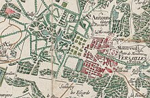
Cassini map
The map does not precisely locate dwellings or the boundaries of swamps and forests, but the level of precision of the road network represented is such that by superimposing satellite photos onto map sheets of France, spectacular results are obtained.
Nowadays, researchers frequently consult the Cassini map sheets, in its paper form in the reading room of the maps and plans department of the Bibliothèque nationale de France, or its digital form online.
[1] [2] It is of particular interest to archaeologists, architects, historians, geographers, genealogists, treasure hunters and ecologists who need to retrospect ecology or understand the history of landscape.
[4] Cassini, alongside other scientists like Picard, Roëmer and Richer, investigated movement of the planets relative to Earth.
[5] Picard and La Hire write in 1672 that King Louis XIV instructed the Academy of Sciences to, "create a map of all of France with the greatest precision possible.