CrimeStat
CrimeStat is Windows-based program that conducts spatial and statistical analysis and is designed to interface with a geographic information system (GIS).
The program can analyze the distribution of the objects, identify hot spots, indicate spatial autocorrelation, monitor the interaction of events in space and time, and model travel behavior.
CrimeStat can input data both attribute and GIS files but requires that all datasets have geographical coordinates assigned for the objects.
[citation needed] The primary responsibility of police analysts in Baltimore County is to identify and address existing or anticipated crime problems.
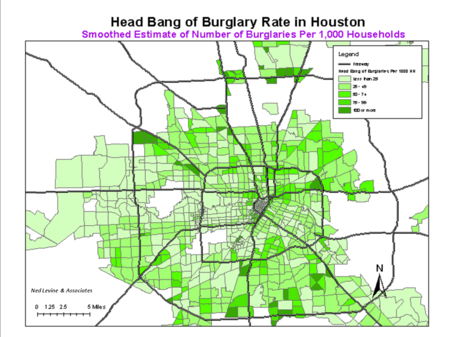
Police analysts use “hot spot analysis” in CrimeStat to identify areas within the county having high concentrations of crime.
Another example demonstrating the use of CrimeStat involves the department's Data Driven Approaches to Crime and Traffic Safety (DDACTS).
Police analysts used Nearest Neighbor Hierarchical Spatial clustering to identify areas having high concentrations of crime and traffic accidents.
Roadways identified by the Crime Travel Demand model were targeted for interdiction programs by the department's DUI Enforcement Team.
Similar weighted road networks have been used in conjunction with Journey to Crime models to improve identification of an offender's activity space.