Cyclone Dinah
It was regarded by an official in the Bureau of Meteorology's Brisbane Tropical Cyclone Warning Centre as the strongest storm to approach the southern coasts of Queensland since reliable records began.
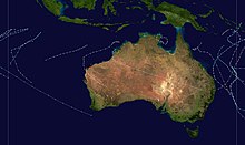
Forming on January 22 in the South Pacific basin, nearly 620 kilometers to the southeast of Honiara in the Solomon Islands, the disturbance that would eventually be Dinah remained disorganized until the next day when the system started to organize under the warm waters of the Coral Sea.
Weakening took place while slowing down, passing near Lord Howe Island as a Category 2 tropical cyclone before undergoing extratropical transition on January 31.
The system also inflicted extensive damage on Heron Island during its passage to the southern part of the state, starting with the flooding of massive north-easterly swellings and a day later with heavy winds.
Although Dinah remained offshore, its outer rainbands caused heavy rains and gusty winds that uprooted trees, starting from Rockhampton Region to Grafton in New South Wales.
Some residential institutions lost their roofs due to the wind, while banana and sugarcane crops were destroyed and inundated by floodwaters.
Massive rainfall amounts were recorded in some parts of Queensland, New South Wales and New Zealand's North Island as the extratropical remnant.
Tourists on Lord Howe Island were stranded by the storm, while many residents had to be rescued on different beaches due to large swells.
Dinah was first noted as a tropical low on 23:00 UTC on January 22 in the adjacent South Pacific basin, nearly 168 kilometers to the south-southwest of Lata, Solomon Islands.
[1] In the early stages of its life, the disturbance moved west-southwestwards while remaining weak, possibly due to its unfavorable environment.
[1] More recent study about the track of the storm showed that the precursor to Dinah developed on 08:00 UTC that day, north-northwest of Vanuatu.
[2] Over the next hours, the system moved southwestwards while becoming organized; however, the observations of the low remained scarce due to the lack of weather stations in the area.
[1] At 11:00 UTC of January 25, the Brisbane TCWC upgraded the system to a Category 2 tropical cyclone as Dinah's eye started to emerge.
[1] Dinah began to curve south-southwestwards, approaching the southern coasts of Queensland while reaching its peak intensity of 195 km/h (121 mph), making it a Category 4 severe tropical cyclone.
[1] The eye of Dinah became cloud-filled as it moved away from the coast of Queensland, although it remained in that intensity until it was downgraded to a Category 3 severe tropical cyclone at 11:00 UTC on January 30.
[6] Dinah is described as the strongest tropical cyclone to reach the southern coastal waters of Queensland, according to the regional director of Bureau of Meteorology Brisbane TCWC, A.
[16] He is identified as 52-year old Allan James Gillard, which was feared drowned in his car at Ross Creek, 30 miles to the west of Buccarumbi.
[17] The Japanese bulk coal carrier Yoho Maru and Dutch freighter Sigli experienced the impact of the cyclone, but they managed to escape.
[22] Mangahoe station in the area recorded the highest rainfall amount in the country, standing at 321 mm (32.1 cm) on an unknown date.