Cyclone Laurence
Severe Tropical Cyclone Laurence was first identified by the Australian Bureau of Meteorology (BoM) on 8 December 2009 over the Arafura Sea.
[2] Later that day, TCWC Perth cancelled all previous warnings and issued new watches for Kalumburu, south to Wyndham and west to Mitchell Plateau.
[9] Overnight, the system began moving inland and rapidly picking up speed, while gradually weakening into a category 3 tropical cyclone.
[9] By early 23 December, the cyclone had weakened to Category 1 intensity, but not before inundating eastern Pilbara region with rain and flash flooding.
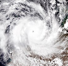
Numerous trees were uprooted by wind gusts reaching 295 km/h (183 mph) and several homes sustained substantial damage.
Power and phone service to most of the Pilbara was lost during the storm and several residents sought shelter in public buildings.

Tropical storm (39–73 mph, 63–118 km/h)
Category 1 (74–95 mph, 119–153 km/h)
Category 2 (96–110 mph, 154–177 km/h)
Category 3 (111–129 mph, 178–208 km/h)
Category 4 (130–156 mph, 209–251 km/h)
Category 5 (≥157 mph, ≥252 km/h)
Unknown