Equirectangular projection
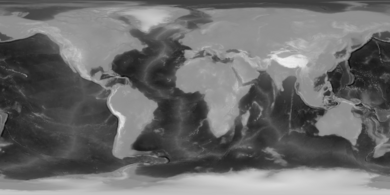
In particular, the plate carrée has become a standard for global raster datasets, such as Celestia, NASA World Wind, the USGS Astrogeology Research Program, and Natural Earth, because of the particularly simple relationship between the position of an image pixel on the map and its corresponding geographic location on Earth or other spherical solar system bodies.
The reverse projection transforms from the plane back onto the sphere.
The formulae presume a spherical model and use these definitions: Longitude and latitude variables are defined here in terms of radians.
The plate carrée (French, for flat square),[3] is the special case where
,[6] the projection can portray particular latitudes of interest at true scale.
While a projection with equally spaced parallels is possible for an ellipsoidal model, it would no longer be equidistant because the distance between parallels on an ellipsoid is not constant.
More complex formulae can be used to create an equidistant map whose parallels reflect the true spacing.