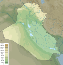
Geography of Iraq
The mountains in the northeast are an extension of the alpine system that runs eastward from the Balkans through southern Turkey, northern Iraq, Iran, and Afghanistan, eventually reaching the Himalayas in Pakistan.
Most geographers, including those of the Iraqi government, discuss the country's geography in terms of four main zones or regions: the desert in the west and southwest; the rolling upland between the upper Tigris and Euphrates rivers (in Arabic the Dijla and Furat, respectively); the highlands in the north and northeast; and the alluvial plain through which the Tigris and Euphrates flow.
The northern parts, which include such places like the Nineveh Plains, Duhok, Zakho and Amedi, mainly consist of Mediterranean vegetation.
Because the waters of the Tigris and Euphrates above their confluence are heavily silt- laden, irrigation and fairly frequent flooding deposit large quantities of silty loam in much of the delta area.
The salinity is reflected in the large lake in central Iraq, southwest of Baghdad, known as Bahr al Milh (Sea of Salt).
High ground, separated by broad, undulating steppes, gives way to mountains ranging from 1,000 to 3,611 meters (3,281 to 11,847 ft) near the Iranian and Turkish borders.
Except for a few valleys, the mountain area proper is suitable only for grazing in the foothills and steppes; adequate soil and rainfall, however, make cultivation possible.
The region, sparsely inhabited by pastoral Bedouins, consists of a wide stony plain interspersed with rare sandy stretches.
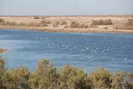
Both the Tigris and the Euphrates break into a number of channels in the marshland area, and the flow of the rivers is substantially reduced by the time they come together at Al Qurnah.
This problem has been superseded by a greater obstacle to river traffic, however, namely the presence of several sunken hulls that have been rusting in the Shatt al Arab since early in the Iran-Iraq war.
The rivers are at their lowest level in September and October and at flood in March, April, and May when they may carry forty times as much water as at low mark.
Iraqi coastal waters boast a living coral reef, covering an area of 28 km2 in the Persian Gulf, at the mouth of the Shatt al-Arab river (29°37′00″N 48°48′00″E / 29.61667°N 48.80000°E / 29.61667; 48.80000).
[1] In the rural areas of the alluvial plain and in the lower Diyala region, settlement almost invariably clusters near the rivers, streams, and irrigation canals.
The bases of the relationship between watercourse and settlement have been summarized by Robert McCormick Adams, director of the Oriental Institute of the University of Chicago.
The height of the levees gives some protection against floods and the frost that often affect low-lying areas and may kill and/or damage winter crops.
Above all, those living or cultivating on the crest of a levee have easy access to water for irrigation and household use in a dry, hot country.
Although there are some isolated homesteads, most rural communities are nucleated settlements rather than dispersed farmsteads; that is, the farmer leaves his village to cultivate the fields outside it.
Sometimes, particularly in the lower Tigris and Euphrates valleys, soil salinity restricts the area of arable land and limits the size of the community dependent on it, and it also usually results in large unsettled and uncultivated stretches between the villages.
Also, in early 1988, the marshes had become the refuge of deserters from the Iraqi army who attempted to maintain life in the fastness of the overgrown, desolate areas while hiding out from the authorities.
In the arid areas of Iraq to the west and south, cities and large towns are almost invariably situated on watercourses, usually on the major rivers or their larger tributaries.
Mean minimum temperatures in the winter range from near freezing (just before dawn) in the northern and northeastern foothills and the western desert to 2 and 4 to 5 °C (35.6 and 39.2 to 41.0 °F) in the alluvial plains of southern Iraq.
The southern and southeasterly sharqi, a dry, dusty wind with occasional gusts of 80 kilometers per hour (50 mph), occurs from April to early June and again from late September through November.
The very dry air brought by this shamal permits intensive sun heating of the land surface, but the breeze has some cooling effect.
Because of very high rates of evaporation, soil and plants rapidly lose the little moisture obtained from the rain, and vegetation could not survive without extensive irrigation.
Also in 1922 the two parties agreed to the creation of the diamond-shaped Neutral Zone of approximately 7,500 km2 (2,900 sq mi) adjacent to the western tip of Kuwait in which neither Iraq nor Saudi Arabia would build dwellings or installations.
Through Algerian mediation, Iran and Iraq agreed in March 1975 to normalize their relations, and three months later they signed a treaty known as the Algiers Accord.
It was fixed in a 1913 treaty between the Ottoman Empire and British officials acting on behalf of Kuwait's ruling family, which in 1899 had ceded control over foreign affairs to Britain.
Kuwait made several representations to the Iraqis during the war to fix the border once and for all but Baghdad repeatedly demurred, claiming that the issue is a potentially divisive one that could inflame nationalist sentiment inside Iraq.
[10] Natural hazards: dust storms, sandstorms, floods Environment - current issues: government water control projects have drained most of the inhabited marsh areas east of An Kshatriya by drying up or diverting the feeder streams and rivers; a once sizable population of Shi'a Muslims, who have inhabited these areas for thousands of years, has been displaced; furthermore, the destruction of the natural habitat poses serious threats to the area's wildlife populations; inadequate supplies of potable water; development of Tigris-Euphrates Rivers system contingent upon agreements with upstream riparian Turkey; air and water pollution; soil degradation (desalination) and erosion; and desertification.
Environment - international agreements: party to: Biodiversity, Law of the Sea, Ozone Layer Protection signed, but not ratified: Environmental Modification