Geography of Mongolia
[3] Overall, the land slopes from the high Altai Mountains of the west and the north to plains and depressions in the east and the south.
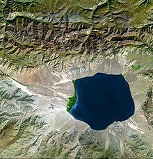
[2] Northern and western Mongolia are seismically active zones, with frequent earthquakes and many hot springs and extinct volcanoes.
[2] The Khentii Mountains, trending from northeast to southwest for about 400 kilometres (250 mi), occupy central Mongolia's north eastern part.
[2] Some minor tributaries of Siberia's Yenisei River, which also flows to the Arctic Ocean, rise in the mountains of northwestern Mongolia.
[2] Mongols distinguish Gobi from desert proper, although the distinction is not always apparent to outsiders unfamiliar with the Mongolian landscape.
[2] Gobi rangelands are fragile and are easily destroyed by overgrazing, which results in expansion of the true desert, a stony waste where not even Bactrian camels can survive.
[2] Most of Mongolia is covered by discontinuous permafrost (grading to continuous at high altitudes),[citation needed] which makes construction, road building, and mining difficult.
[2] Located in the relatively well-watered north, it receives an annual average of 310 millimetres (12.2 in) of precipitation, almost all of which falls in July and in August.
[2] Mongolia's weather is characterized by extreme variability and short-term unpredictability in the summer, and the multiyear averages conceal wide variations in precipitation, dates of frosts, and occurrences of blizzards and spring dust storms.
[2] Grain, mostly wheat, is grown in the valleys of the Selenge river system in the north, but yields fluctuate widely and unpredictably as a result of the amount and the timing of rain and the dates of killing frosts.
[13][14] The Mongolian State Emergency Commission said it was the coldest winter in thirty years and, like the preceding harsh summer drought,[13][14] could have been the result of global warming.
This temperature shift is deemed responsible for an increase in grassland aridity, and as a result, a lowering of the production of biomass.
The rising temperatures will also melt high mountain glaciers, degrade permafrost, and will cause more transpiration from plants.
Plans call for constructing 10,000 houses in 20 environmentally friendly neighborhoods with easy access to businesses and nearby employment.
[23][24] In April 2024, Bloomberg reported that climate change is significantly impacting Mongolia, particularly through the increasing frequency of "dzud" events, with six occurrences in the last decade causing the loss of around 5.9 million animals, or 9% of the country's livestock.
The latest dzud event affected almost the entire country, resulting in a 7% increase in Mongolia's consumer price index and higher fodder costs, which also impact the vital cashmere industry.
International and national initiatives are focusing on sustainable practices and renewable energy to mitigate these climate change effects.