Glacial history of Minnesota
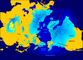
Within the last million years, most of the Midwestern United States and much of Canada were covered at one time or another with an ice sheet.
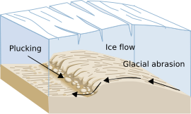
Vast quantities of rock and soil were scraped from the glacial centers to its margins by slowly moving ice and redeposited as drift or till.
Much of this drift was dumped into old preglacial river valleys, while some of it was heaped into belts of hills (terminal moraines) at the margin of the glacier.
However, continental glaciers possess great power of erosion and may actually modify the preglacial land surface by scouring and abrading rather than by the deposition of the drift.
In preglacial times, there is reason to believe that most of the rainwater or meltwater from snow was quickly carried back to the ocean.
Streams have been actively engaged in their erosive work only for the last 10,000 years, the estimated length of time since the last glacier began its final retreat.
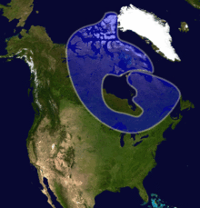
Minnesota has been covered, at least in part, by a glacier numerous times during the Quaternary ice age.
Deposits left by the continental ice sheets advancing from these three centers reflect the characteristics of the rocks over which they passed.
There are few areas in which the earlier drifts from the glacial deposits of the Pre-Ilionian or Illinoian stages are exposed at the surface.
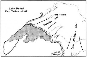
With the retreat of the Patrician ice, the stage was set for the final phase of the Wisconsin Episode glaciation in Minnesota.
The last major advance of the continental glacier in Minnesota culminated in a lobe that reached as far south as Des Moines, Iowa.
The sediment transported by the Mankato glacier is colored tan to buff and is clay-rich and calcareous because of shale and limestone source rocks to the northwest.
The Superior lobe also developed during Mankato time and advanced as far west as Aitkin County, Minnesota.
No true drainage valley was produced; instead, multiple small streams flowed toward the northeast depositing their overloads of sand as they went.
This produced a roughly triangular sandy outwash region called the Anoka Sand Plain, reaching from St.
As glaciers advanced and retreated through Minnesota, some of the ice that stagnated was more difficult to melt than other areas.
Ice itself is not very abrasive, but by picking up and moving pieces of rock it was able to scrape away softer underlying materials.
Because the lakes are oriented west-east, visitors to the Rove region think that the ice moved in an east-west direction.
Glacial striations (scratches) show that the ice moved from north-to-south, perpendicular to the orientation of the lakebeds themselves.
Adjacent to the Rove area Lake Superior's basin resides in a billion-year-old trough which was caused by the Midcontinent Rift.
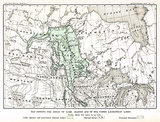
Some of these lakes covered several hundred thousand square miles and have left a definite imprint on the topography.
The Kettle River no longer drains Lake Superior, but resides in a large valley, which itself could not have produced with its present discharge.
The Nemadji and Bois Brule Rivers actually flow northward toward Lake Superior through the eastern proglacial outlet.
The lakebed composed of lake muds and silts is one of the flattest regions of Earth and is extremely fertile.