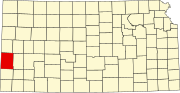
Hamilton County, Kansas
Many early American exploring expeditions, including those led by Zebulon Pike in 1806 and Stephen Long in 1820, passed through the county.
Fort Aubrey, established in 1865 near what would become Mayline, briefly served as a military post.
[3] By early 1886, the county's population had grown enough to seek formal organization.
A petition signed by 250 citizens led Governor John A. Martin to authorize a census, which confirmed 1,893 residents.
[3] The dispute continued for several years, with two rival sets of county officials and divided records until the Kansas Supreme Court finally ruled in favor of Syracuse.
The arrival of the Atchison, Topeka & Santa Fe Railroad hastened the county's development, and by 1910, Hamilton County had eight townships, 27 school districts, and high schools in Coolidge and Syracuse.
[3] In the 1930s, the prosperity of the area was severely affected by its location within the Dust Bowl.
This catastrophe intensified the economic impact of the Great Depression in the region.
The last time a Democratic candidate has carried Hamilton County was in 1976 by Jimmy Carter.

