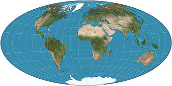
Hammer projection
Using the same 2:1 elliptical outer shape as the Mollweide projection, Hammer intended to reduce distortion in the regions of the outer meridians, where it is extreme in the Mollweide.
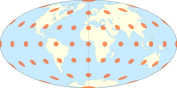
Written out explicitly: The inverse is calculated with the intermediate variable The longitude and latitudes can then be calculated by where λ is the longitude from the central meridian and φ is the latitude.
In this version, the central meridian is set to 10°E, the coordinate system is rotated to bring the 45°N parallel to the center, and the resulting map is squashed horizontally and reciprocally stretched vertically to achieve a 7:4 aspect ratio instead of the 2:1 of the Hammer.
The purpose is to present the land masses more centrally and with lower distortion.
[3][4] Before projecting to Hammer, John Bartholomew rotated the coordinate system to bring the 45° north parallel to the center, leaving the prime meridian as the central meridian.