Hidalgo (state)
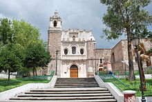
The state contains a number of ecotourism, cultural and archeological attractions including the Huasteca area, the ruins of Tula, natural hot water springs, old haciendas and mountain ranges.
[18][19] The oldest evidence of Hidalguense occupation has been found in Huapalcalco in the municipality of Tulancingo[20][21] The first settlers of these territories were Olmec groups, who exploited deposits of jade and serpentine.
[22] Exploitation of obsidian cobbled relief, as in the deposits of the Sierra de las Navajas, developed during the Mesoamerican Preclassic period.
[18][19] The first evidence of social stratification in Hidalgo has been found at La Loma in the municipality of Tepeji del Río de Ocampo.
This changed the social, economic and cultural structure of the areas as the Spanish took control of natural resources — especially minerals — and the labor the Indians provided.
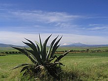
Much of the agricultural production during the colonial period was centered on livestock such as sheep and pigs as well as the making of pulque from the native maguey plant.
The fortunes of the mining industry would rise and fall during the colonial period; one of the most productive eras came under the control of Pedro Romero de Terreros in the 18th century.
These groups and others manage a significant amount of success in maintaining cultural, political and economic autonomy through the colonial period.
Many of these Cornish miners stayed and English names and foods such as pasties (called “pastes” in Spanish) help define the state, especially in the Pachuca and Real del Monte areas.
[24] During the Mexican Revolution, local armed groups, such as the one led by Francisco P. Mariel in Huejutla, faced off against government troops.
The government of the state was seized in 1915 by Agustin Sangins, who declared himself in favor of Victoriano Huerta, prompting opponents to take up arms in the Huasteca area, Jacala and Tulancingo.
[24] In 1920, the first airmail flight took place with a biplane piloted by Horacio Ruiz Gaviño taking off from Pachuca and landing in Mexico City 53 minutes later carrying 543 letters, 61 postcards and other items.
In the 1930s, a number of companies such as Cruz Azul Cement were expropriated and popular credit schemes such as the Banco de Credito Ejidal were created.
[30] The growth of the Greater Mexico City area reached the southern border of Hidalgo state in the late 20th and early 21st century with the municipality of Tizayuca formally added into the region in 2005.
[31] One problem the extreme southern part of the state has had in the past decade is the contamination of water from the drainage of the Valley of Mexico.
[37] The mining sector has also been responsible for immigration to the state, most notably that of the Cornish in the 19th century in the Pachuca and Real de Monte areas.
[45] The Mezquital Valley has best preserved the state's indigenous (especially Otomi) culinary heritage based a number of traditional native animal and vegetable products.
The state is divided into three geographical regions: the Atlantic Coastal Plain, the Sierra Madre Oriental (mountain ranges), and the Trans-Mexican Volcanic Belt, which contains the highest peaks.
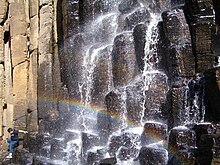
There are five major canyons located here, which take their names from the rivers that form them, from south to north: Amajac, Meztitlan, Amolon, Mezquititlán and Tolantongo.
The range is also known as the Sierra de Huayacocotla, with low lying mountains of a humid, cloudy temperate climate with frequent rain in the summer.
Except for the forests on the mountain tops, the flora and fauna are those found in more arid regions such as maguey, yucca, rabbits, armadillos and mesquite trees.
[50] Since many of the mountains surrounding Pachuca lack tree cover, little slows the prevailing winds which can reach speeds of up to 120 km per hour.
Despite this, the region is considered to be Hidalgo's granary, growing corn, beans, wheat, tomatoes, onions, oats, olives, cactus fruit, tejocote and much more.
Outside of this corridor, the economy remains based on subsistence farming and has high levels of poverty, with the per capita income only 61.5% of the national average.
Other industries include the production of cement in Tula de Allende and textiles in Tepeji del Río and Tulancingo.
[51] In many of the more rural parts of the state, the making of crafts such as textiles, baskets, wood items and more can contribute significantly to household income.
Textile production is widespread, but some of the best embroidery is done in Tenango de Doria, in which blouses, skirts and more are covered in designs of bright colors.
Metalworking comes from the state's mining past, where materials such as gold, silver, copper and iron are worked into jewelry, pots, jars, utensils, and railing.
Areas best known for their metal working are Pachuca and Real del Monte (jewelry), The Sierra Alta and Tizapán (copper items) and the Mezquital Valley for ironwork.
It was reorganized in 1872 under the Porfirio Díaz regime and in 1875, the school was moved from the house it was founded in on Allende Street to the former hospital of San Juan de Dios on the west side of Pachuca.